Caveat: The State of the OGF Topo Layer

[The following is a cross-post from my other blog.]

This will be a fairly long write-up, so depending on your interests, you can skip sections that aren’t useful to you.

First I will write about the OGF topo layer, and give a tour of its current status, with some discussion of how it works.

Then in subsequent sections I will try to discuss how to create or edit your own contributions to the OGF Topo layer.

Part I – Introducing The OGF Topo Layer

The term “topo” (short for topographic) refers to a style of map that shows the physical elevation of land, either through shading or drawing contour lines or both. There are many topo renders available for the OpenStreetMap platform. My own favorite for daily use is the Cycle Map layer on OSM – not for any specific reason except that it’s easy to get to – it’s included right there in the layer selector for the OSM site. The best known, however, and one of the oldest, is the separately built and maintained OpenTopoMap. The code for OpenTopoMap is freely available on github.

All the various implementations of topo style for OpenStreetMap rely on the easy availability of free data from the United States’ NASA. This agency did a planet-wide survey of the elevation of all the land in the world on an arc-second (approx. 30-meter) grid, using radar, and published that data, online, for anyone to use. This data is called “SRTM”. Developers implementing OpenStreetMap’s various topo layers are able to download and use this SRTM data to use as a raw source of the detailed topographic information needed to draw the map. So, in the case of OpenTopoMap, the SRTM data is loaded to the render machine, processed in various ways, and turned into the hillshading, contour lines, and map-elevation color shading that we all know and love.

For the real world, getting topo data is matter of launching a spacecraft or satellite with a little radar range-finder on it, and flying over the surface of the earth finding how high each part of the earth is relative to some baseline (i.e. mean high sea level). Easy! But OpenGeofiction is on a fictional planet. To repurprose Virginia Woolf’s famous line: There’s no there, there.

Instead we have to sit down and make up each square of elevation information – there’s got to be a 30-meter square grid for our entire imaginary planet, and we have to invent the elevation for each and every square! And just randomizing this isn’t going to work – real world topographic data betrays the evolved geophysical patterns of our planet, influenced by everything from plate tectonics to vulcanism to erosion to human landscaping. The data is going to have to either be “drawn” by creative human hands, or “drawn” by well-trained machine-learning AI’s. Both are possible in principle, but then we have the data problem.

The data problem is this: the NASA SRTM format was developed for storing real world data. But no one ever thought: we need a nice, user-friendly, SRTM file editor! Why? Because no one needs to edit real-world data. It came from a super-precise scientific gadget, who’s going to need to edit that? They could only mess it up.

So there simply does not exist any easy way to get the “imaginary” SRTM files that we need for our topo layer. Some geofiction genius is going to need to write a converter.

Luckily, OpenGeofiction has such a genius. The original creator of OpenGeofiction, Thilo, wrote a little program that turns a standard OSM XML format file (.osm) that has been filled with hand-drawn contour lines (tagged contour=elevation / ele=nnn) into a pseudo-SRTM format file (.hgt). Then we just need to install the standard OpenTopoMap software on our render server, copy the pseudo-SRTM files across, and voila, topo for OGF!

Still, we have a whole planet to cover. At this point in time (the time of writing this article, early 2022) the overall coverage for OGF’s topo layer is tiny, and of fairly low quality, on average, so far.

One of the main reasons I started my “OGF Mirror” project, last year, was because Thilo had decided he could no longer invest the time and energy required to support the topo layer for OpenGeofiction. I had a strong desire to see the topo layer continue to be supported and expand. Eventually that “OGF Mirror” became the migration project and I and user wangi and some other admin took over running OGF from Thilo, with his blessing. So it was my interest in topo that led to my taking on all this work for OGF, and therefore it remains of a focus of my efforts, moving forward.

Part II – The Current OGF Topo Zones

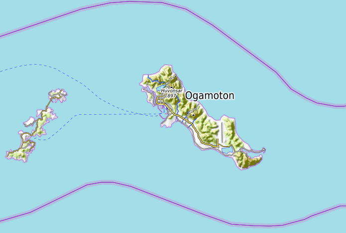
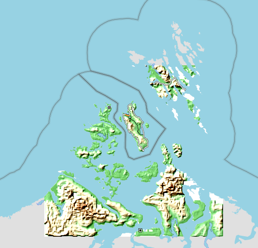
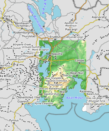
OpenGeofiction currently has 14 actively maintained topo zones. Here they are, in alphabetical order.

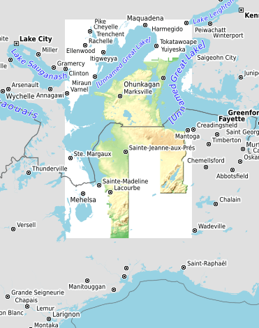
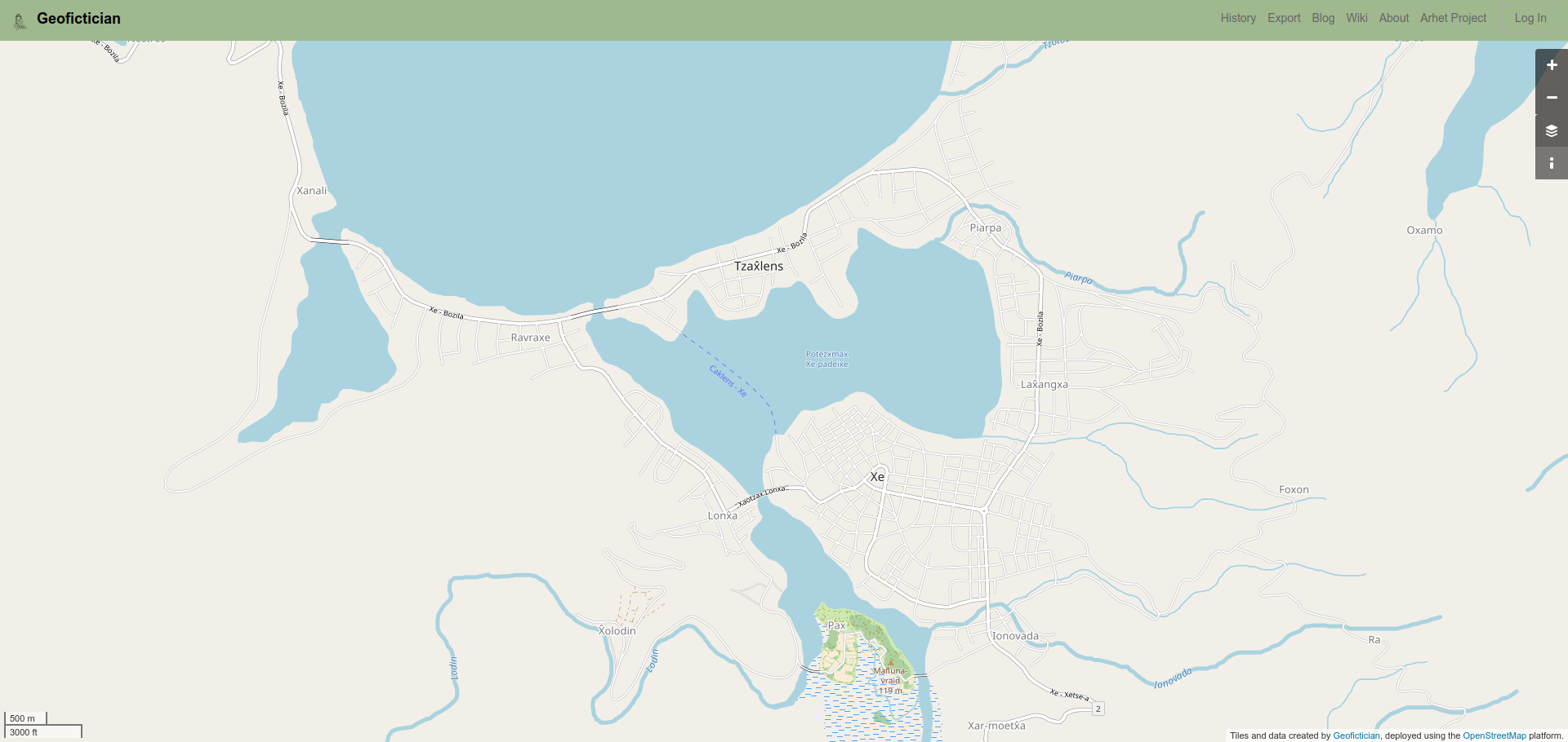
zone-alved

This zone has been created by mapper SwissCrusader. It’s a first draft, and clearly needs a lot of cleanup work, but it’s an excellent and ambitious start.

picture

zone-gobras

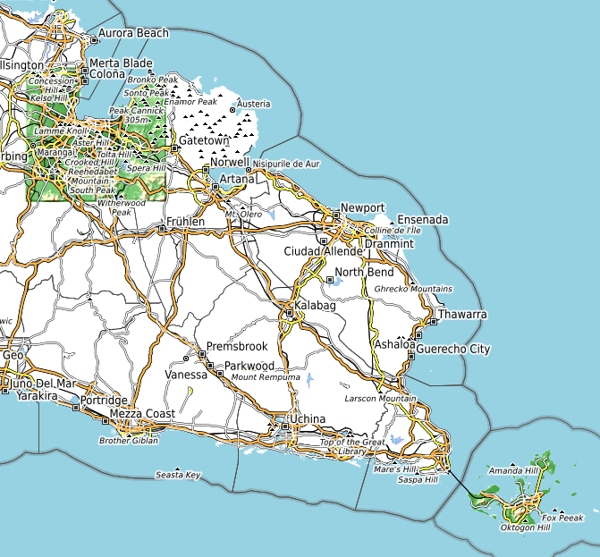
This zone actually is two smaller areas that have been combined because of their close proximity. The older is the topo work for Khaiwoon, on the eastern tip of the Gobrassanya peninsula. The territory is one of the oldest on OGF. It was developed by user isleño with a lot of additional mapping by user histor. The contours were drawn as a collaboration between thilo and isleño. The other is the background topo for Gobras City, to the northwest. Gobras City is one of the most successful wholly public and collaborative projects on OGF, created by a very large number of different mappers over almost a decade, now. User Ūdilugbulgidħū volunteered to draw contours for the city, and in my opinion, they are quite excellent. Obviously, since the contours were drawn after much of the city, and since there is work in the city drawn without a strong awareness of the contours, there are areas where the human development (roads, etc) doesn’t really properly “match” the contours as drawn.

picture

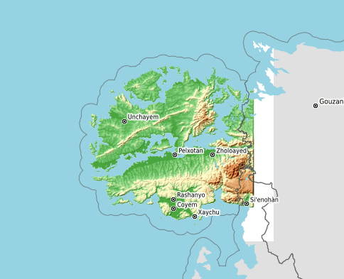
zone-gwynian

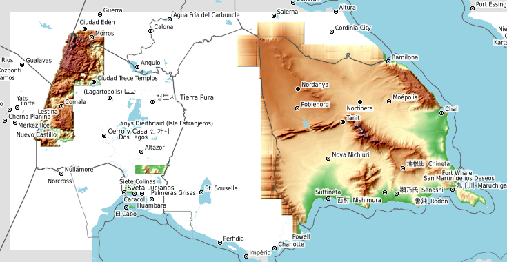
This zone is also actually two adjacent areas combined because of proximity. The older part, to the west, is my own work (user Luciano), drawn for my territory Ardisphere, in 2014-2016. I think it has well-done areas, but it’s quite noticeably incomplete, full of lacunae and missing expanses and weird glitches where the contour work is too sparse to properly cover the map. The newer part, currently in development by user Martinawa, is the largest single expanse of topo work on OGF, and still in early stages across most of the territory, but it’s got a lot of promise.

picture

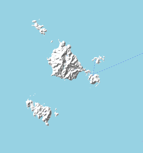
zone-hesperis

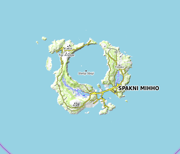
This is a quite small but complete set of contours for an island territory drawn by mapper Ūdilugbulgidħū.

picture

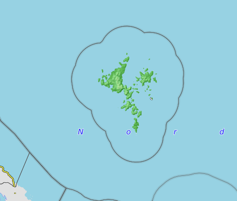
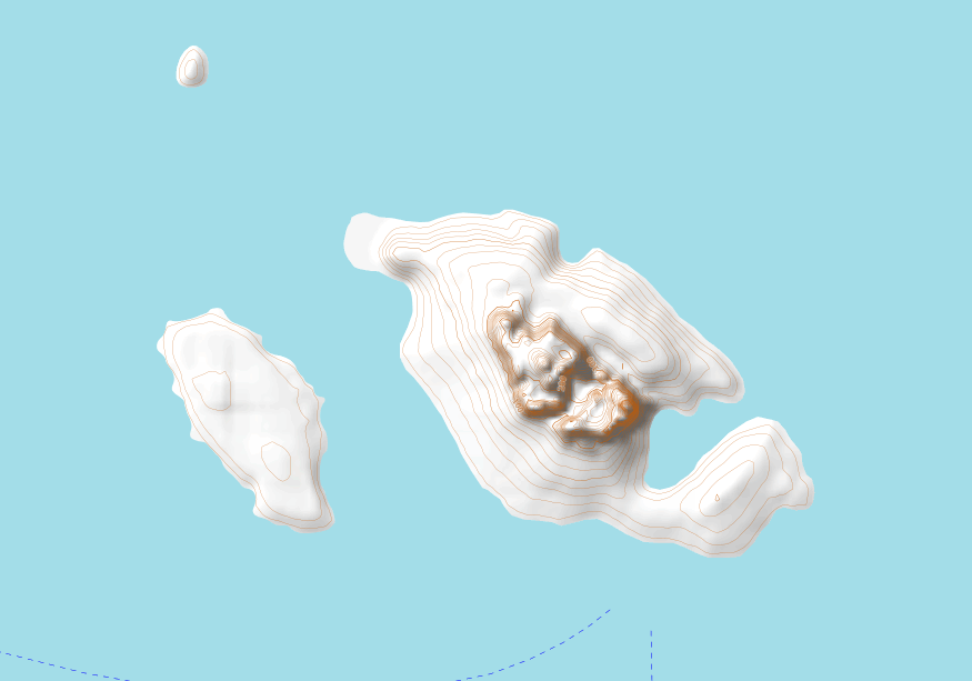
zone-iscu

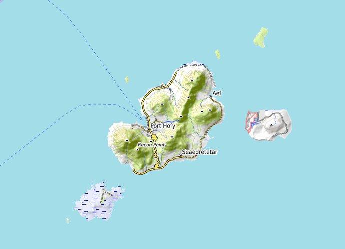
This zone includes several islands in a chain called Iscu, drawn by mapper Lithium-Ion. The contours are quite detailed and excellent.

picture

zone-izaland

This zone includes a few of the southern islands of a the nation called Izaland, by the user Izaland Terramorphing Committee. I’m looking forward to seeing more of Izaland getting contours.

picture

zone-january

I (user Luciano) drew these islands as part of a collaborative effort between myself and mapper deltanz. I later turned over the islands to deltanz. Personally I think they are my “most complete” set of contours among those I have done.

picture

zone-kofuku

This is a new effort by mapper Huachachi. Kofuku is an immense territory and so far these are just a few islands off that country’s north coast. They are excellently done, and I’m looking forward to seeing more of Kofuku with contours.

picture

zone-kojo

I (user Luciano) did a small spot of contours in collaboration with user Leowezy some years ago, in the southernmost spot of this zone, at the Joenji Peninsula. Leowezy has subsequently been gradually adding other areas of coverage for his territory, Kojo. Hopefully will come in the future.

picture

zone-makaska

This zone actually overlaps not just the territory of Makaska, but also the one to the south, called Ooayatais. I (user Luciano) own both of these territories. The northern territory, Makaska, has a very complete set of contours and is work I’m quite proud of. The southern territory, Ooayatais is much lower quality and, for now, also quite incomplete. It’s my “current project” with contour mapping, however, and hopefully sometime later this year I’ll upload a major update.

picture

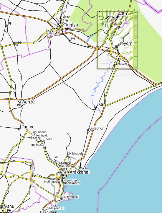
zone-roantra

This is the oldest and, arguably, best of all the topo zones on OGF. User thilo, the original creator of OpenGeofiction, uploaded this topo zone when he first created the OGF server, for his territory Roantra. It is the archetype of OSM-style topo work.

picture

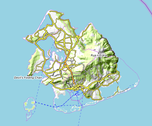
zone-ruanerara

This is a small project done by user Toadwart for his outlying (overseas) territory of his country, KA076 (apparently this mapper recently decided to change the name of the country, and the new name hasn’t been decided on). Anyway, the contours are clearly still in development but I’m looking forward to seeing more progress.

picture

zone-tapira

This zone, a small island, was created by mapper Ūdilugbulgidħū, but he subsequently gave up the territory. It’s someone’s chance to take on an already-existing topo project.

picture

zone-tarrases

This is another of my own (user Luciano) territories. The Duchy of Tárrases is the one case where I quite successfully imposed a set of contours on an already-created map. I’m quite happy with the result. The surrounding islands used to be owned by me, too, but for now they are in a bit of limbo. For that reason I haven’t bothered to repair the mess of half-finished contours on those surrounding islands.

picture

Part III – Create A New Topo Zone

There is quite a bit of work involved in creating a new topo zone for the ogf-topo rendering process. Multiple new working and data directories must be created, code must be added to xml layer specifications and data-processing scripts, and the proper raw contour templates need to be created and populated with initial draft contour data.

Therefore if you want to create a new topo zone for your OGF territory, you need to contact me and we can discuss, so I can get things set up and I can create the templates you’ll need to draw your contours (see next section). There is nothing wrong with diving in and drawing contours for yourself before contacting me, but bear in mind you’ll probably end up doing a lot of cutting and pasting and manipulation using the JOSM editor once I’ve created those templates for you, because I will no longer accept contour data drawn in files other than the pre-created templates.

If you’re trying to decide whether or not you want to create a topo zone, one good way to get a feel for what’s involved is to download one of the osm-squares from the server (see below) and just go ahead and open that up in JOSM and try to get a feel for how it works and what’s involved. Start with something small, complete and well-done, like the January Islands or Hesperis (see above).

Part IV – Edit or Improve An Existing Topo Zone

In the past, I’ve allowed users to simply submit new, hand-drawn “contour files” which I then clean up and process using the tools at hand. However, I have found that the first step – cleaning up the submitted files – can be quite tedious and time-consuming, and further, I often end up repeating work as newly submitted files have the same problems as previous iterations.

I would like to move toward a more reliable system of iterative improvement. To do this, if there is an already-existing topo zone and you want to add to it or improve it, you must download the existing osm-squares (contour files) from the ogfsrtm server, edit those, and send the edited copies of those files back to me. Do not try to bypass this process – I have special tags embedded in those contour files as found on the server, and I’ll know if you haven’t used those as a basis for your edits.

You can find downloadable individual squares for most topo zones at this location on the ogfsrtm server: https://ogfsrtm.rent-a-planet.com/osm-squares/

If a given square is missing from the server, contact me and I’ll create an initial template for that square and post it there, that you can then edit. Don’t try to create squares not found on the server.

Part V – An Alternative Pathway To Maintaining Your Own Topo Zone

If all this business of drawing vast numbers of contour lines in JOSM is not your style, there is, in fact, an alternative. You can directly submit NASA-SRTM format compliant .hgt files. This bypasses the whole contour conversion process, and would be quite a bit easier for me to do.

That said, so far, no one has done this successfully. There have been challenges to finding a program that produces .hgt files in the exact NASA-SRTM format expected by the OpenTopoMap rendering software. If, as a community, we find such a tool in the future, that may make a lot of what’s written above obsolete and we’ll have a better way to do things, moving forward.

Regardless, if you want to try doing it this way, you still need to contact me in advance, so I can set up the new zone on the render server – that aspect won’t change. Then you’d send me the pseudo-SRTM files (.hgt) so I can post them on the ogfsrtm server in the proper directory, since that’s where the render server expects to find them.
picture

Caveat: на хуй

At the geopolitical level, I think Putin and the Russian military have miscalculated.

Despite this (or preliminary to this), I should go on record that I actually agree with their “logic” on one key point: Ukraine, historically, is a part of Russia (or, depending on the point in history and the particular patch of land, Poland). Which is to say, Russian revanchist fantasies have some foundation in historical fact. The separate Ukrainian SSR was only carved off of Russia by Lenin in the 1920’s, and the Ukrainian national identity was essentially an artifice wrought by the half-hearted multiculturalist tendencies of the Soviet experiment. As Lenin said (hypocrisy alert), “The proletariat must demand the right of political secession for the colonies and for the nations that ‘its own’ nation oppresses. Unless it does this, proletarian internationalism will remain a meaningless phrase; mutual confidence and class solidarity between the workers of the oppressing and oppressed nations will be impossible.”

This Russian mistake, however, will be their undoing. If Ukraine lacked a “founding myth” and identity before now, Russia’s invasion is giving them one. From now on and far into the future, this Russian invasion of Ukraine will be the kind of foundational myth for Ukrainians that they never had before – and that will happen regardless of whether they win or lose the current war. If they win, then it will be a myth on the same level as George Washington and the American Revolution. If they lose, they become guerilla partisans like the Palestinians on the West Bank, and forge a distinct Ukrainian identity on that basis.

There is no scenario under which Ukraine fails to become a truly distinct nation in the geopolitical sense, as a direct consequence of Russia’s actions. And personally, I think that’s something that had been in doubt, until now. Putin’s “real-world geofiction” is not going to alter the map in the way that he hopes.

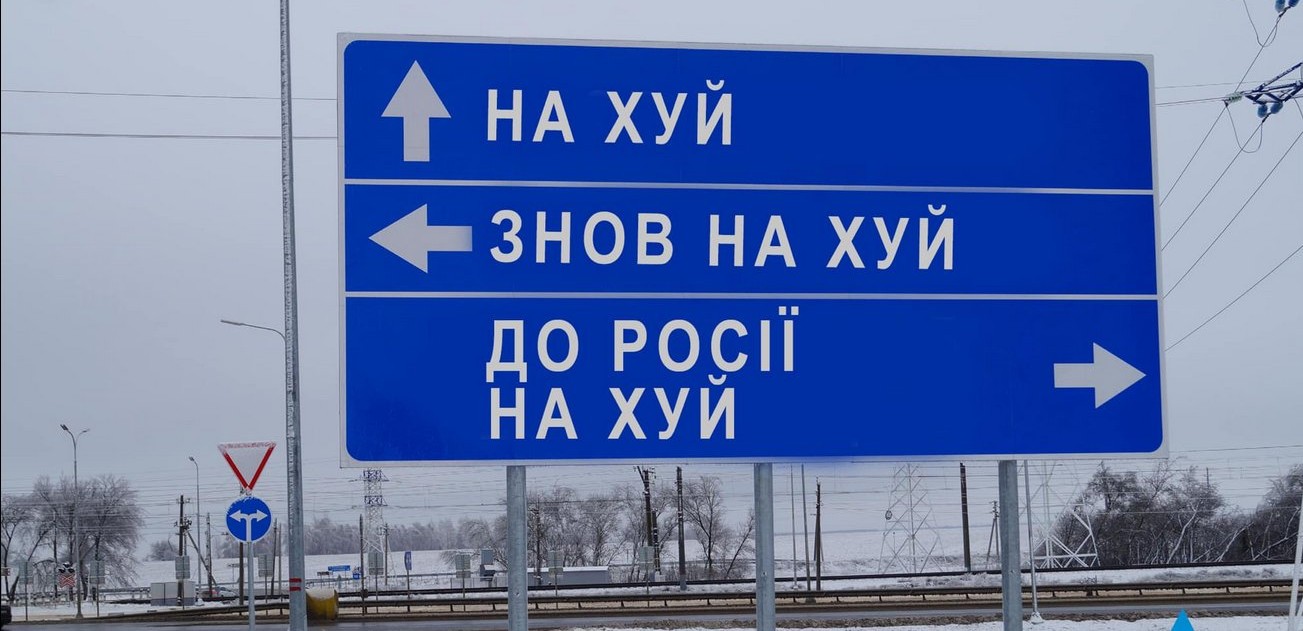
Here is the Ukrainian Highway Signs Agency, contributing to the information war:

picture

The sign has been altered to say, loosely, “Fuck Off / Fuck Off More / Fuck Off Back to Russia”.

picture

Caveat: Documentation of layers

I have been trying to develop some user-friendly documentation for the map layers on the main opengeofiction.net website (where I am server host and technical administrator). I have written quite a bit over the last 24 hours, and posted it to two articles on the OpenGeofiction wiki.

For those who might think I’m just a layabout and don’t do much, here is evidence to the contrary.
picture

Caveat: Definitely take the tram

I found this story hugely amusing, and thought-provoking too.

There’s a lot of context required to make sense of this story. The author, John Holbo, a philosopher whose bloggings I frequently read on the group-blog Crooked Timber, explains much of that context in a supplemental webpage – so I’ll not make any major duplicative effort here.

The minimal context: the story is a parody of (or extension/sequel to) Ursula Le Guin’s story, “The Ones Who Walk Away From Omelas”. Without knowing that story, you will be hard put to begin to make sense of Holbo’s creation. Unfortunately, as he points out too, there is no freely accessible web version of her story – it’s still under copyright and requires purchasing a version of the text (ebook, paper book, audiobook). Anyway, wikipedia has a good summary.

I am tempted to add a town called Omelas to my fictional maps – and it should definitely be accessible by tram. Actually, my geofictions are full of such “easter eggs” (as they’re called in the realm of modern electronic-domain creative works, such as computer games and websites): references to other works of fiction and tributes to other authors’ geofictions.

picture

Caveat: On staying up late babysitting cantankerous webservers…

Wednesday night has become “server maintenance night” for my opengeofiction.net website hosting project. With more than 200 active users, there has to be a fixed time that is announced in advance for server updates, changes, tests and reboots. We have settled on 0400 Thursdays UTC, which comes down to 8 PM Alaska Daylight Time (next week that’ll be 7 PM Alaska Standard Time).

Last night what was hoped to be just a regular backup and reboot of the main server, and a “refresh” of the carto (map rendering i.e. map-picture-drawing) server turned into an all-night odyssey, as I struggled with a bizarre failure on the render server that pushed me to having to restore the whole server from the previous night’s automated backup. I still don’t know what went wrong – the render program refused to restart after the manual reboot which was part of the render server “refresh.” As is so often the case with these Linuxy-sysadmin problems, I suspect something went awry with file permissions.

Anyway, it was one of those proverbial IT adventures, and with my normally very fixed, habitual sleep times, I made and drank some coffee late in the night in order to be able to stay awake to do what needed to be done, which further messed up my sleep when I finally was able to go to sleep. So now I’m… messed up, sleepwise.

There’s a less personal and more upbeat mention of the event, posted to my other blog, here, which was also cross-posted to the “User Diaries” on the OpenGeofiction server, here.
picture

Caveat: Storms Material and Virtual

A somewhat stressful day.

I had a crisis on the map server last night and this morning, with the tool called “certbot” – a tool we use on the server to make sure the OGF webpages are secure (“https”). And that also caused problems with our automated emailing from the server, which supports functions like new user sign up, lost password recovery, and replication monitoring (making sure data goes over to the render and to overpass correctly). I had to shut down the server without much advance notice – I was worried the problem was worse than it was, and so I was trying to solve it quickly. So that was an issue for the users.

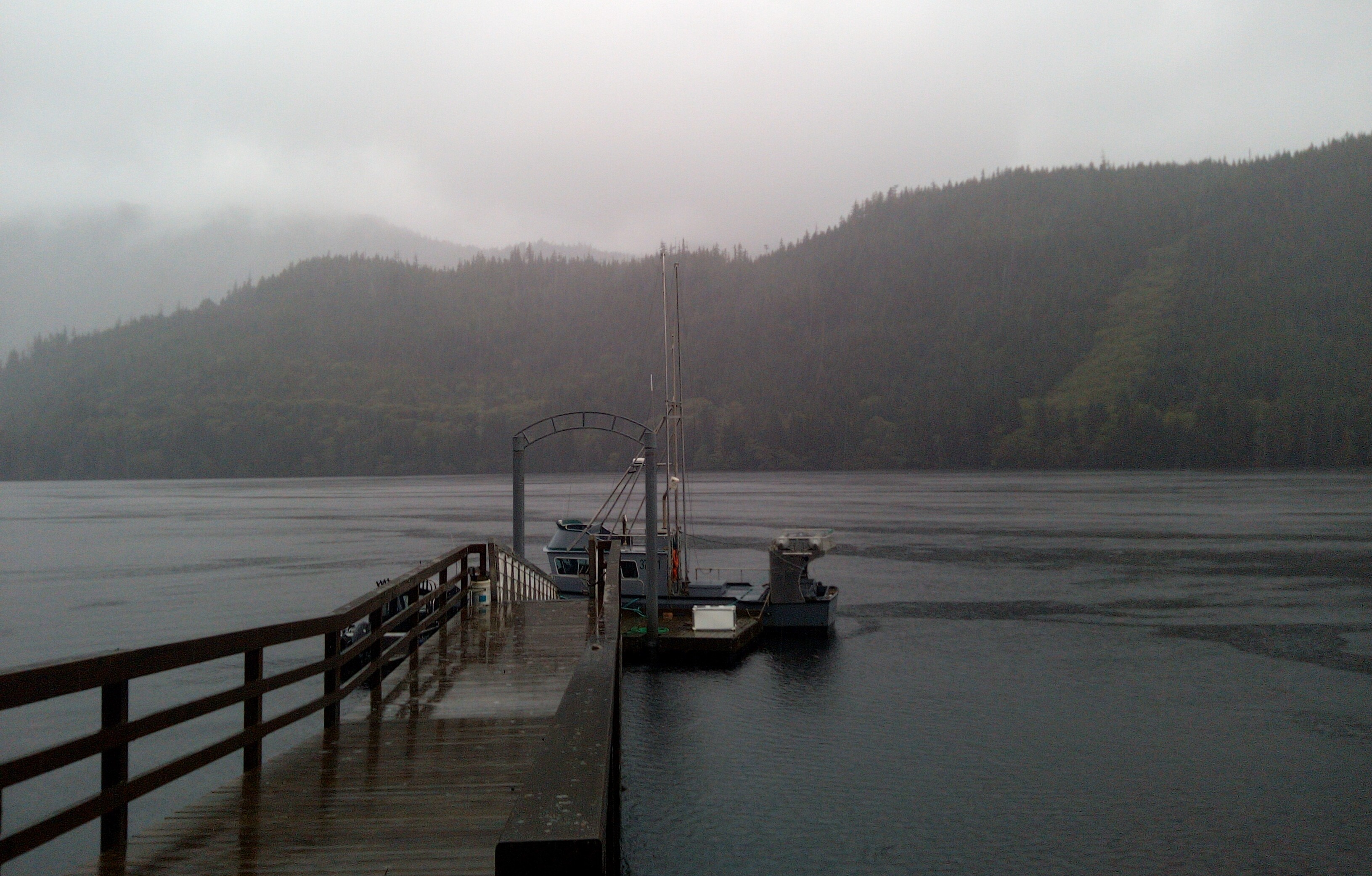
Meanwhile, we’re having a big storm here, weather-wise. The marine forecast was calling for 40-foot swells on the open ocean here, and up to 10-foot swells right on Bucareli Bay, at the mouth of Port Saint Nick.

Our neighbors-down-the-road, Fred and Pat, were concerned about the impact of high seas and wind on their boat, so they asked Art if they could park their commercial fishing craft at our dock. Of course we are happy to help – they’ve done it before – Arthur has the most sheltered dock of all of Port Saint Nick, because we are the farthest inland, at the head of the fjord. Anyway, it’s turnabout – Pat’s the one who rescued me when I got the blueberry (Art’s Chevy Tahoe) stuck in a snowbank a while back.

So Fred and Pat parked their big boat at the dock, after we moved Art’s smaller boat off to one side.

It’s very windy and rainy and blowy, right now.

picture

picture[daily log: walking, 3km]

Caveat: New server, same old city, but less old than before

[This is cross-posted from my other blog.]

Having worked furiously, all summer, in taking over the hosting for Opengeofiction, I have now finally reached a point where I feel like investing some time in the creative side – and actually work on the map again for a while.

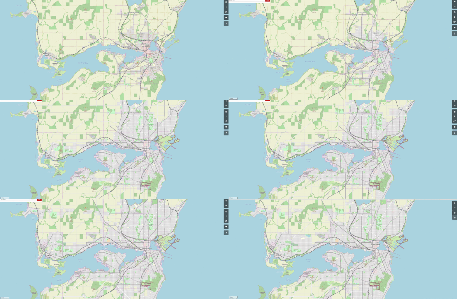
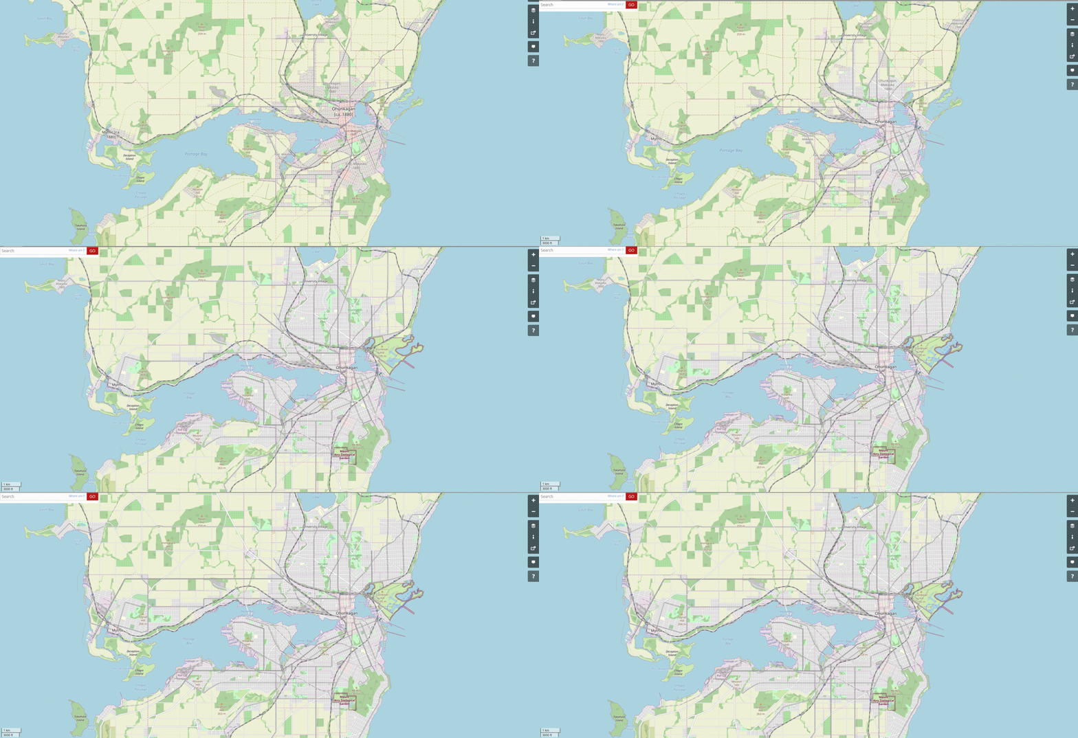
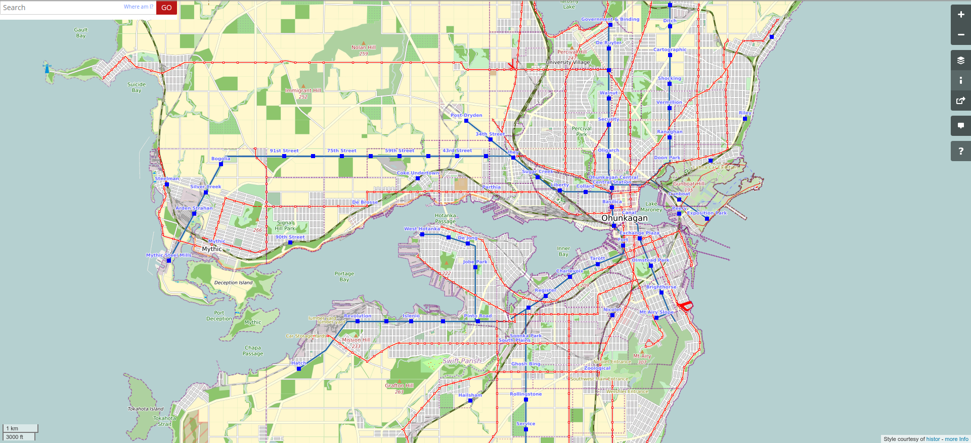
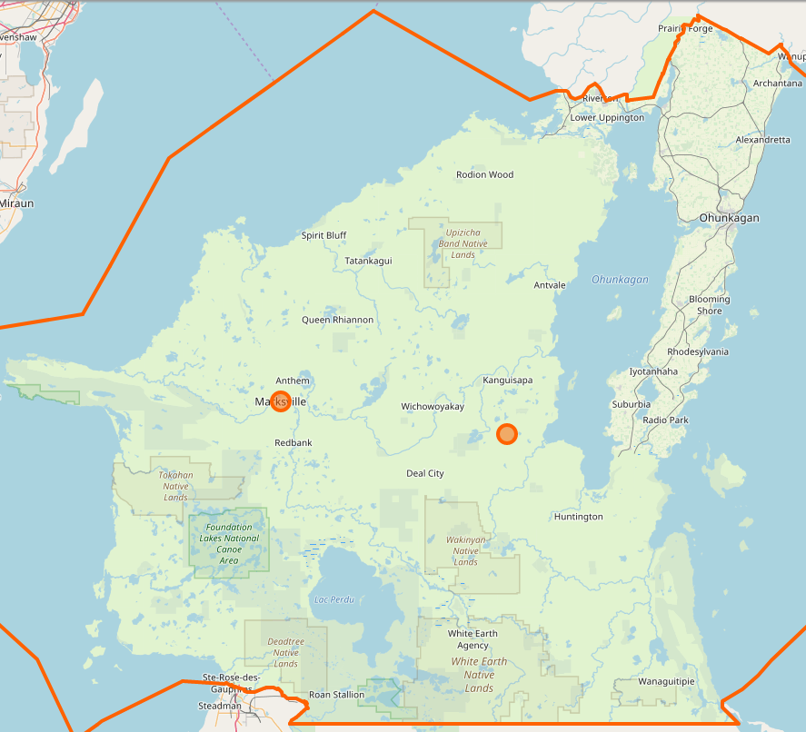
I have added quite a bit of new area to the city of Ohunkagan. I’ve been saying that, within my “historical approach,” that I’ve brought it up to 1920, but I think there’s more I want to do before I call it officially caught up to 1920. So let’s call it 1917 or so. Also, some of the surrounding communities are still back before 1900 – e.g. Prairie Forge, Iyotanhaha, Riverton. They need to catch up, too. So here’s the new “work-in-progress” gif. picture

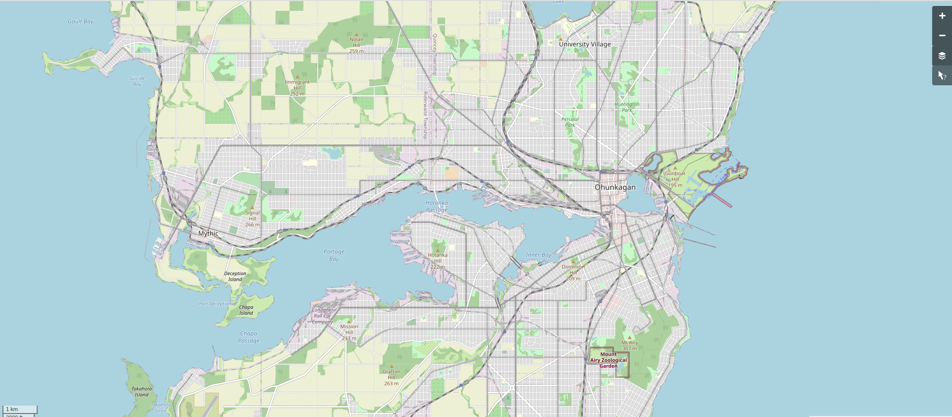
Here is the current snapshot.

picture [Technical note: screenshot taken at this URL (for future screenshots to match).]

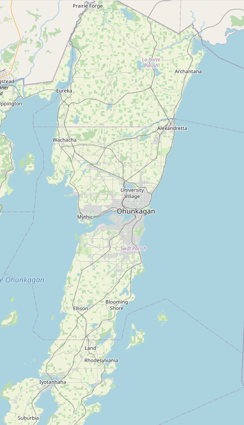
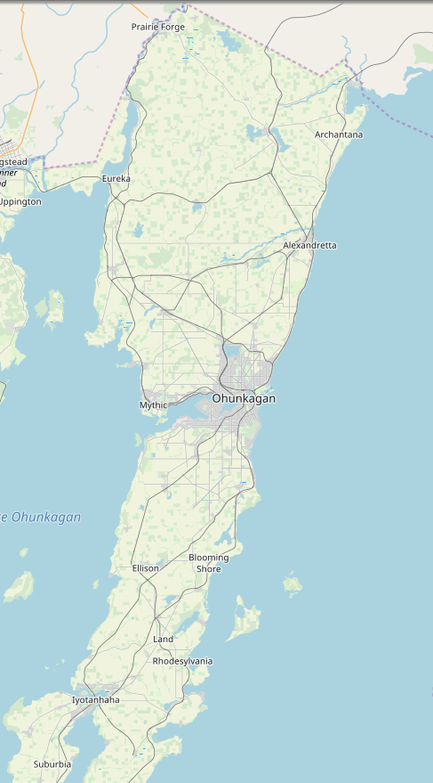
Here’s the wider area snapshot.

picture

[Technical note: screenshot taken at this URL (for future screenshots to match).]

picture

Caveat: Unscheduled Maintenance

Today has been stressful. But stress “of my own creation,” for a change – since it has been about this volunteer systems administrator role I’ve taken on for this new version of the old website.

The website crashed this morning. In a way where I didn’t understand what was going on, where we had to take it offline and study the problem with limited resources, where we had to deal with all the customers (users – these are not paying customers, it’s a free site) who wanted to know what was going on.

We made progress on diagnosing the problem, but the site is still offline. Tomorrow I’ll work on trying to get it back up and available again.

picture

picture

Caveat: OGF Live

[This is cross-posted from my other blog.]

The OGFMirror became opengeofiction.net, over the weekend.

This is huge news.

So far the site is working okay. Not great, just okay. There are some issues.

  • The ActionController::InvalidAuthenticityToken is frequent and painful, for users.
  • Possibly related to the above – users keep getting forcibly logged out, over and and over.
  • The render is still playing catchup on the whole world map, and seems to be lagging around 2 hours for high zooms.
  • Incoming email is completely broken – possibly due to errors in the DNS tables at the opengeofiction.net registrar (and we’re waiting on the old host to fix this)
  • Outgoing email is problematic for some substantial portion of users due to over-aggressive anti-spam efforts by several major email providers, including Apple (icloud) and Microsoft (hotmail, outlook, live). I’m not even sure how to begin fixing this. I’ve implemented DKIM, but this also relies on fixing DNS errors which are not currently being fixed, and that might help. I’ve looked into a blacklisting of my email server by spamhaus.org and discovered it is due to my email server sharing the same IP range with a Nigerian Prince or somesuch in the server farm where it lives.

Work continues. Meanwhile, to all the users of OGF: “Happy mapping!”
picture

Caveat: Depseudonymized

I have always operated under a pseudonym on my geofiction websites. But as of today, as I become the official host of the main site, opengeofiction.net, I had to depseudonymize myself – because a person hosting a website on a server with many users in countries all over the world has a sort of obligation toward transparency. This isn’t precisely a legal requirement – though who knows, with so many different jurisdictions involved. But it feels like at the least a sort of ethical requirement.

Opengeofiction.net was created in Germany by a guy named Thilo in 2012. I joined the site in early 2014, and served for many years as a volunteer administrator. Recently, Thilo has become disillusioned (or otherly-illusioned) and no longer wanted to maintain the site. But with hundreds of active users, it seemed unkind to shut the thing down. So I have taken it over, along with some colleagues, also fellow volunteer administrators. Effective today, the site is hosted on a couple of my servers down in California, and I’m the lead technical support.

This is not about making money, exactly. Though I expect some donations to help me at least break even on the rent for the servers.

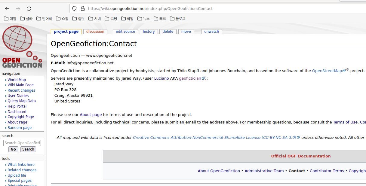
Here is a screenshot of the “contact” page from the site – showing me depseudonymized for my fellow geoficticians.

picture

picture

Caveat: Tree #953

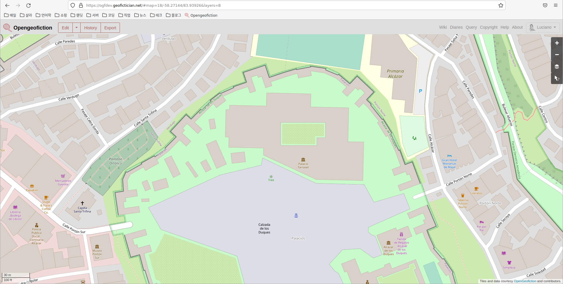
This tree – located at the center of this map screenshot – is imaginary: a real dot on a real map of an imaginary place.
picture
I placed this tree earlier today because I am testing the functionality of the new opengeofiction map server. As of right now, the “old” server is down. The new server is running, but only in testing mode, so I won’t place a link. I’ll add a link to the tree on the map server when it goes “live” – maybe later tomorrow or Sunday. This is part of a long ongoing project, mentioned before, to build a replacement website for opengeofiction. The moment of truth approaches…

picture[daily log: walking, 1km]

Caveat: OGFMirror

[The below is cross-posted from my other blog.]

I’m super bad about posting to this blog. That’s partly because I feel a strong desire to report some actual, positive progress, which I haven’t felt enabled to do.

I have been very busy with HRATE technicalities. I am building – very, very slowly – a “mirror” for opengeofiction.net (OGF). I think if this is successful, then the owner of that site, who has expressed interest in “letting go” of having to continue to maintain it, will allow the mirror to take over for the site and a transition to a new hosting environment will be complete.

Someday, I intend to write up, in elaborate, technical detail, this process of setting up a mirror. But in broad outlines, here is what it involves (has involved, will involve).

  • Build a new Ubuntu 20.04 LTS server. This leads to lots of incompatibilities farther down the line, because the existing OGF server is an older version. Install the basics – apache, postgresql, etc.
  • Install an OSM rails port on the server.
  • Migrate the OGF data to this server. This was very, very hard – because the OGF data (in either .osm.pbf format, or in pg_dump format) proved to contain inconsistencies (data corruption). Some missing current nodes and ways had to be restored manually (text-editing .osm = .xml files). This ended up a 2-weeks-long process.
  • Set up incoming replication from the source apidb (OGF) to the new mirror (currently being called ogfdev).
  • Set up outgoing replication for the new ogfdev instance (to drive render, overpass, etc)
  • Set up a new primary render. This had some sub-parts.
    • coastlines. This proved very difficult, because as far as I can figure out, the osmcoastline tool used to create the coastline shapefiles is broken on Ubuntu 20.04. An older version must be used. My current workaround: I’m actually running coastlines on an older server. I import a coastline-containing pbf file to the older server, run the osmcoastline tool, and post the shapefiles for consumption on the render server.
    • I made a decision to run the renders on a different server than the apidb. I think this might involve a bit more expense, short term, but it makes the whole set of processes more scalable, long term. My experience with Arhet is that the render requires scaling sooner / more frequently than the apidb, as the user base grows. Installing the render software (mod_tile and “renderd”) proved difficult. It turns out that there are some lacunae and downright incorrect steps in the documented installation sequences on github.
    • Set up incoming replication from the ogfdev database to the render database.
    • There are substantial differences in recent versions of the openstreetmap-carto style – specifically, the special shapefiles are no longer stored in as datafiles in data folder in the render directory. Instead, the shapefiles are loaded to the database. Because non-standard shapefiles are used, this means rewriting the load procedures (python scripts) – the standard approach is to just grab the files for “Earth” (because who would run osm for some other planet?!). So that file-grabbing is hard-coded in the procedure.
  • Set up a new topo render. The topo render was shut down on OGF, so this will be the only working version. Unfortunately, I ran into a similar problem with some of the topo pre-processing as I ran into with osmcoastline, above. I suspect for the same reason – something in one of the dependencies they both have. So the topo pre-processing (turning the .hgt files into a contour database) is also being run on a separate, Ubuntu 18.04 server (just like the coastlines).
  • Set up appropriate changes and customizations for the front-facing rails port (osm website). This involves importing user data (done) but also user diaries (not done). These require ad hoc SQL coding that give me flashbacks to my job as DBA in the 2000’s. Another unfinished piece – internationalization. The current ogfmirror website looks okay, but only in English. Switch to another language, and it all reverts to OSM boilerplate. Why is internationalization done so badly on production software of this kind? I see no easy solution except manually editing each language’s .yml file in turn (OSM has a 100+ languages). Or building my own damn application to achieve that result.
  • Set up overpass and overpass-turbo. Overpass installs relatively painlessly, but I’m having trouble getting incoming replication to work correctly. overpass-turbo was quite difficult – the current version on github is flat-out broken, and so an older version (commit) must be compiled and installed. Further, the compilation and configuration process overwrites some of the parameters files, so the parameters files have to be modified after running the first steps of configuration, but before the last part. This is the step I am on right now.
  • Set up nominatim? – nice to have, but not urgent. Anyway nominatim doesn’t work on the existing OGF website
  • Implement some of the custom tools that are available on the OGF website: the “scale helper,” the “coastline helper,”…
  • What else? This is a work in progress…

So I’ve been busy. Here is a link to the site. Bear in mind, if you are reading this in the future, the link may not show you what I’m currently writing about, but rather some future iteration of it.

https://ogfmirror.com

I’m still working on some of those last steps. Open to hearing what else needs to be done.


What I’m listening to right now.

K-os, “Hallelujah.”
picture

Caveat: Postgresql blues

I have been putting a lot of energy, this last week or so, in trying to scope out a new project related to my “map server,” which I’ve mentioned here often in the past. Really what I’m trying to do is create a space for a viable “mirror” of the main geofiction site where I first started this online map-drawing hobby while convalescing from my cancer surgery in 2013. That site is suffering performance issues and the owner of the site is too busy and disinterested in proper maintenance, and so the user community (about 200 active users) is concerned that the site will just “go down” one of these days without recourse for the users, and with a loss of all the creative work that’s been done there.

To build a mirror, I need to handle a much larger data-set than I do for my own little, previously-mentioned map server. And I have been wrestling with the database application used by the map server software, that goes under the brand name “PostgreSQL,” trying to get my development server to handle the much larger data-set. For comparison, my Arhet map server’s backup file is about 25MB. The opengeofiction map server’s backup file is 850MB. That’s a 34x increase in size.

So I tweak various running parameters for the database and the data-loading tool, called osm2pgsql, in hopes of getting it to work. So far, there is definitely a failure point at around 250MB. I spend a lot of time staring at the database monitoring screen on the server, trying to see what the point of failure is.
picture

picture

Caveat: raggedsign

Contrary to superficial appearances on this here blog, I’ve not been a layabout, in recent weeks. I’ve been quite productive in the sphere of website building and administrative work.
This spurt of productivity was impelled by a request from the owners of the gift shop, where I work part-time. They wanted me to build them an improved website for their “other business” – a cabin rental business for tourists in Klawock.
That website is now “live” and running well, hosted on one of my servers – same as this blog and all my other various web projects. You can visit that website: aplacetostayinak.com.
This work has led to a whole host of ancillary projects, as I try to clean up and update my several servers. I felt that if I was actually going to start being paid for what has so long been a hobby, I should get my proverbial ducks in a row.
By far the most difficult thing I’ve done wasn’t building that new website, but rather it was rebuilding, from the bottom up (i.e. from bare-bones, brand new “blank” server) my “map server,” which I’ve mentioned many times here. This has been necessary since my giant server crash a few months ago, and having the old server running, with all its problems and wasted space, was very inefficient. By doing this, I could free up a lot of space for new projects without shelling out for another new server. It was quite a job, and I’m proud of the outcome, though it’s the least glamorous, since in fact the objective was to get it looking and behaving exactly as the old map server. So if you go to my map server, at its new address, you’ll see something exactly the same as my old map server (which I have now shut down). The new map server is: arhet.rent-a-planet.com.
Another difficult thing I accomplished is that I have finally built my own email server – after many years of wanting to. Nothing will change as far as reaching out to me. I haven’t “killed” any of my existing email addresses, and my gmail one remains my “primary.” But having my own email server simplifies website administration and hosting substantially – a website server produces a number of automated, administrative emails, in the vein of responses to “Lost your password?” queries or “Server backup job completed at 07:00 AKDT”.  It is actually pretty hard to get such emails to go out correctly when you don’t control your own email host. So I built one. I placed it on one of my many domains: craig-alaska.net.
As a side note, therefore, if anyone who knows me wants a customized email address, I now have the ability to provide that. The email server includes a “webmail” interface, so if you really wanted to, and trusted me enough, you could throw away your gmail account and be fulano@craig-alaska.net (or any of my other domains, or your own if you want to buy one).
I also set up a blog for a neighbor and good friend of Arthur’s, Jeff. He hasn’t done much with it, but I’m going to be providing him with some orientation so he can get his blog started: akjeff.com
Having done all that, and thinking about the fact that I am earning money from a few of these web programming adventures (though not at all breaking even, yet), I decided it was time to declare my web design and hosting “business” in some kind of official way. So I built yet another website, which is my “business” – such as as stands. Currently the income is less than the cost of the servers I have. Not to mention the programming time is, so far, “free.” I’m doing it as a hobby, I guess, but if I’m going to be making some money with it, I might as well try to look professional.
That new website: raggedsign.com. I would welcome feedback on appearance and text – it’s quite rudimentary and “first draft,” right now.
“raggedsign” is a name I came up with in around 2001 or 2002, as a kind of “brand name” for my efforts at learning website design and web programming. It went into extended dormancy during my decade in Korea and I only recently decided to resume using it for the same, original purpose. I have also used the brand-name “general semiotics” for my computer-related work, specifically my year and a bit as an independent “database design consultant” in 2006-07. I still own that domain, too, and for now I’ve redirected generalsemiotics.net to the raggedsign site.
My next project is to provide a new “Topo layer” for the opengeofiction.net site where I am still active, bearing an informal “administrator emeritus” title. The previous “Topo layer” for that site was deactivated due to performance issues, but I have always been one of its biggest users and fans. So rather than complain to the other admin people on that site about the now-missing topo layer, I thought I’ll take on hosting one, myself – if I can. There are some technical hurdles to be overcome. But I think I’ll manage it.
picture

Caveat: Poem #1743 “El vaquero de Gojangú”

ㅁ
 Como estamos descansando
 quisiera en este canzó
 contarles lo que pasó
 allá en el llano a un vaquero,
 nombre de Che Quim el fiero,
 p'acá de Gojangú andó.

– un fragmento poético en métrica romance.
I wrote this bit of poetry in around 2015. It’s a bit complex in terms of what it’s meant to be – it’s a fragment of a poem embedded in a fiction, so it has its own “author” within that fiction. I had been quite involved in creating fictional “wiki articles” about one of my imaginary countries, at the time, and this poem occupies that space. I still have some of those wiki articles hosted on my own wiki – here is the article about this poem. Note that the poem’s protagonist, Che Quim, is a “fictional character” within the broader fiction that is the enclosing wiki article – if that makes sense. He’s doubly fictional.
picture

Caveat: Font Fail

[The below is cross-posted from my very sparsely-populated other blog.]
I have taken some steps to migrate one of my major geofictions – The Ardisphere – from OGF to my self-hosted OGFish clone, Arhet. The reason for this is that OGF seems increasingly rudderless and destined to eventually crash and burn, and I am emulating the proverbial rat on the sinking ship. I still hugely value the community there. But the backups have become unreliable, the topo layer (of which I was one of the main and most expert users) has been indefinitely disabled, and conceptual space for innovation remains unavailable.
One small problem that I’ve run up against in migrating The Ardisphere to Arhet is that I discovered that Korean characters were not being supported correctly by the main Arhet map render, called arhet-carto. This is a problem because the Ardisphere is a multilingual polity, and Korean (dubbed Gohangukian) is one of the major languages in use, second only to the country’s lingua-franca, Spanish (dubbed Castellanese). I spent nearly two days trying to repair this Korean font problem. I think I have been successful. I had to manually re-install the Google noto set of fonts – noto is notorious (get it?) for being the most exhaustive font collection freely available. I don’t get why the original install failed to get everything – I suspect it’s an Ubuntu (linux) package maintenance problem, rather than anything directly related to the render engine (called renderd, and discussed in other, long-ago entries on this sparsely-edited blog).
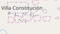
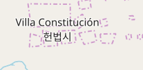
Here (below) are before-and-after screenshot details of a specific city name that showed the problem: Villa Constitución (헌법시) is the capital and largest city in The Ardisphere. Ignore the weird border-artifacts behind the name on these map fragments – the city is in limbo, right now, as I was re-creating it and it got stuck in an unfinished state.
Before – you can see the Korean writing (hangul) is “scattered”:
picture
After – now the hangul is properly-composited:
picture
You can see The Ardisphere on Arhet here – and note that within the Arhet webpage you can switch layers to OGF and see it there too. Same country, different planets!
What I’m listening to right now.

Attack Attack! “Brachyura Bombshell”.
picture

Caveat: Yet Another Map Server

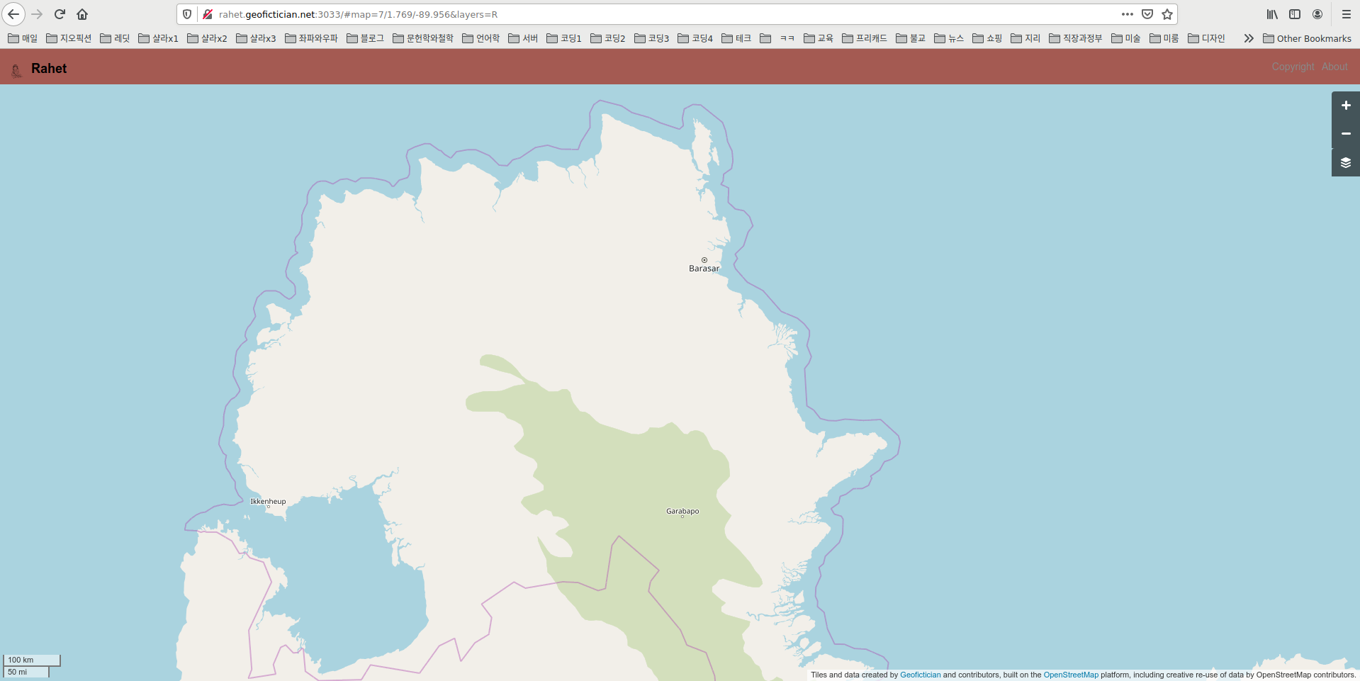
I took the first steps over this past weekend and today to publish a new map server website. Here is a screenshot of its current status in my browser.
picture
This is, maybe, the fourth map server I’ve built from scratch using the OSM (openstreetmap.org) architecture, which is open source.
Partly, I do this because I keep wanting to practice and get better at putting them together. There is quite a bit of code customization required to get the server working on a “non-earth” map. So it’s good to keep in practice.
But also, if this one works adequately, I intend to migrate my Arhet map server (which has 20 or so active users, a few of whom have given me a small amount of money) to a newly built map server, fully segregated from all my various blogs and such. All this time, Arhet as existed at the timorously-named test.geofictician.net, and shared server space with multiple other applications, including this here blog thingy, a wiki, a MUD, and sundry web-doohickeys.
So first, I’m doing this practice run, using another planet, Rahet. The similarity between the names “Arhet” and “Rahet” is not coincidental: they are both anagrams of “Earth”. I intend for all my map servers to have such names.
picture

Caveat: Escapism

The last few days I’ve been engaging in escapism of the purest sort. Frustrated with the world, with my “productive” projects, with Arthur’s curmudgeonly chaos, I’ve retreated into my own world.
After a long time away, I’ve returned to my mapping project for the imaginary city. This is cross-posted from my “other blog.”


I keep doing small historical edits for the city’s Metropolitan Area. I’m up to the year 1904 or so.
I made this cool gif of the mapping progress so far:
picture
Here’s the transit network, on the same frame:
picture
Here is a wider area view – I’m going to start a time series of screenshots for these, too, to show the growth of the metropolitan area.
picture
I have been placing lots of industry and factories and such. I’m most proud of the rail-car factory, here.
picture

Caveat: Round and round

[NOTE: the following is cross-posted from my other blog – just putting it here to show what my “other online persona” looks like.]
I ran across a small, free website that someone made that transforms a flat map of an imaginary planet into a globe that you can rotate with the mouse or that can be used to generate a “spinning world” gif. It’s called maptoglobe.com.
I decided I wanted to make one for my planet, Arhet – just out of curiosity. This did have a few minor technical challenges. First, I had to “knit” together the tile images for Arhet. I found a nice utility that does this, an application called tile-stitch by Eric Fischer. It can be found on github. Except for one small problem, I just followed the documentation provided on the github README. That one problem: to get it to work in my machine, I needed to modify the code in the stitch.c file to include the full path to the geotiff utilities. So…
Original code:...
#include <geotiffio.h>
#include <xtiffio.h>
...

My version:...
#include </usr/include/geotiff/geotiffio.h>
#include </usr/include/geotiff/xtiffio.h>
...

Once that was set up, I simply extracted the tiles at zoom level 5 from the Arhet2-carto render using the tile-stitch utility, with this command
./stitch -o arhet5.png -- -85.05 -179.99 85.05 179.99 5 https://tiles01.rent-a-planet.com/arhet2-carto/{z}/{x}/{y}.png

That got the whole planet into a square .png file, which I called arhet5.png.
The next problem is that the maptoglobe website requires the map image to be in a equirectangular projection. But the tiles for Arhet are in the modified mercator projection used by almost all online “slippy maps,” classified as EPSG:3857.
So the arhet5.png file was in the wrong projection. I found out I could use another utility that I already had, the gdal library, to do this job. I ran the following commands.
/usr/bin/gdal_translate -of Gtiff -co "tfw=yes" -a_ullr -20037508.3427892 20036051.9193368 20037508.3427892 -20036051.9193368 -a_srs "EPSG:3857" "arhet5.png" "arhet5_tfw.tiff"
/usr/bin/gdalwarp -s_srs EPSG:3857 -t_srs EPSG:4326 -ts 6400 3200 "arhet5_tfw.tiff" "arhet5.tif"

These produced a .tif file in the right projection, 6400 x 3200 pixels. I then opened this file and resaved as .png again (because this is a more compact format that is therefore uploadable to maptoglobe.com – which has a maximum file size limit).
I then uploaded that .png file to the maptoglobe site, and it allowed me to save the resulting “globe” – it’s accessible here. Further, I was able to make this nice little spinning planet gif:

That’s the planet Arhet, as it currently stands – note that most of the mapping there is not my own, but the work of the various other Arhet members who have joined me in my experiment.
That worked out so well that I did the same thing for my own private planet, Rahet (note that the names Arhet and Rahet are obviously related; Rahet came first, and when I decided to change the project and invite other participants, I renamed the old Rahet as Arhet, and then resurrected the old Rahet later and as a separate project again).
Here is a the link for Rahet on the maptoglobe site, and here is the spinning planet gif:

So those are pretty cool. Remember that the original “slippy maps” (HRATEs) of these two projects are on the map portion of this website, here and here.
picture

Caveat: imaginary map servers for rent

I have been pretty busy with computer stuff over the last few days.
That is because something new happened. For at least three years, now, I have imagined there might be a path to turning my eccentric computer-based geofiction hobby into some kind of business. Well, I officially have a first customer. I won’t say anything about that person – they may wish to preserve anonymity. But the concept is that they want their own, private “imaginary planet map server” in the style of the real world’s OpenStreetMap or Google Maps. These already exist. OpenGeofiction (“OGF”) is the most popular imaginary one, where I have been an active participant since early 2014. And in 2018 I began my own project, Arhet.
I like to call these “imaginary slippy maps” HRATE‘s: “High Resolution Alternatives to Earth.”
It has seemed to me there might be demand for these things. Geofiction isn’t exactly a popular hobby, but there are several hundred users at OpenGeofiction, and there are websites and communities dedicated to it, including the active reddit r/imaginarymaps. Further, if Hollywood is willing to pay linguists big bucks to create imaginary languages for their stories (e.g. Klingon from Star Trek, Dothraki from Game of Thrones), there might also be creators of large, mass-market fantasy or sci-fi who are also willing to pay money for professional-grade “slippy maps” of imaginary places. The current extant efforts at such things are depressingly amateurish, e.g. this map of Westeros.
pictureA few months ago, I had put out to the OGF community, in a very low-key way, that I would be willing to do the technical work and provide ongoing server hosting and administration to anyone willing to pay a minimum monthly amount on my Patreon account. Patreon is a website used by “creators” (musical performers, programmers, writers, visual artists, etc.) to provide a kind of “pay what you think it’s worth” tool for their fans and customers. On my Patreon account user page, I’d made explicit the concept, as you can see at this link (screenshot at right).
On Monday, someone reached out to me and said they were interested. So I promptly “spun up” a new geofiction server and gave them a log on username for it.
This is not trivial work, however.
I’m using the OpenStreetMap software platform – because it’s free and open source.
But it requires an Ubuntu Linux server (I rent my servers from a company called Linode, since they specialize in Linux servers). My servers live on server farms in California and New Jersey. They are not that expensive – the $20/month rate I set up on Patreon will cover the rental fee for a small server.
Building and running a Linux server from scratch is pretty involved, if it’s to be for a specialized application like a GIS map server (GIS means “Geographic Information Systems”).
I have to install databases (plural!), Apache (the webpage controller), the so-called Rails Port (the website software behind OpenStreetMap, OpenGeofiction, or Arhet), a rendering engine (part of the OpenStreetMap architecture but not integrated to Rails Port). Several of these pieces need customized bits of programming code changes to accommodate a function not in their original design – i.e. hosting an imaginary, non-Earth planet map. Several aspects of the OpenStreetMap platform “hard code” real-world facts and data – because the designers simply never imagined the idea that someone would be using the platform to present non-real-world data. I have to remove code references and datafiles related to Earth’s coastlines, for example, and develop alternate ways to extract that information from the planet database and generate those same datafiles in the correct format. Etc., etc.
Anyway, I’ve got my customer’s planet up and running, including a nicely mapped chain of islands, that the customer asked me to import from their work on OGF. I’m feeling pleased with this. If I get 2 more such customers, I’ll be making enough margin (over and above server rental costs) to support my other tech requirements, such as hosting this here blog. I will not link to this new server I just built, however, since they deserve to have a say in how I publicize their work.
I doubt very much this would ever be a way to make an actual living. But it’s nice to imagine that this hobby could be turned into a supplemental source of income. So maybe it wouldn’t be a “living,” but it would be sufficient to pay for the geofiction hobby and for several other internet-based hobbies that involve money, like this blog. For now, I bought some beer. We shall see.
Meanwhile, as I often say on the OpenGeofiction site: happy mapping.
picture

Caveat: On random, square canyons

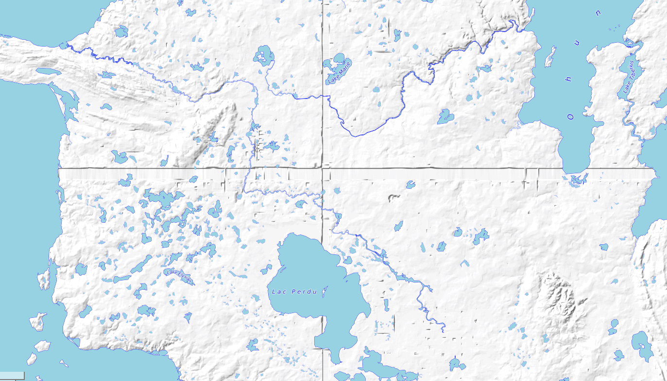
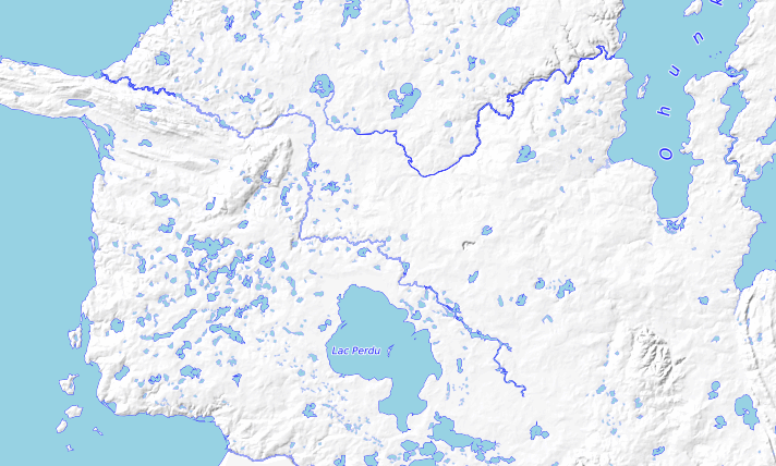
I’ve been trying to solve a strange programming problem on my map server. I have these files containing contour data (elevation data) for my fictional places. Because of the way this information is processed by the openstreetmap platform, I store this data split up into files divided along longitude and latitude lines. But that means there are boundary conditions between the files. When I use the specially-created terrain conversion tools on these files, I seem to often get strange “canyons” along the longitude and latitude lines. They look like this on the map’s contour render.
picture
So I have spent a few days trying to find the right set of parameters for the data conversion programs (developed by the founder of the opengeofiction website) to prevent these artificial canyons from appearing. It seems to be a bit of a hit or miss proposition. I’ve got it looking good now, but I’m still not sure quite what the issue is or how to systematically avoid it.
picture
picture

Caveat: too many planets

I have been busy with trying new stuff and experimenting with my GIS server.
I now have 8 distinct views of 4 distinct “planets” running on the server. Only one of those planets is real – that’s Earth, of course. Included there for comparison purposes.
I have been learning a lot about some new aspects of GIS systems admin under the OSM architecture. That’s good I guess. Good to learn new things.
picture
picture

Caveat: logs and lettuces and loopy isolines

I worked on my firewood collection for a while in the morning.
picture
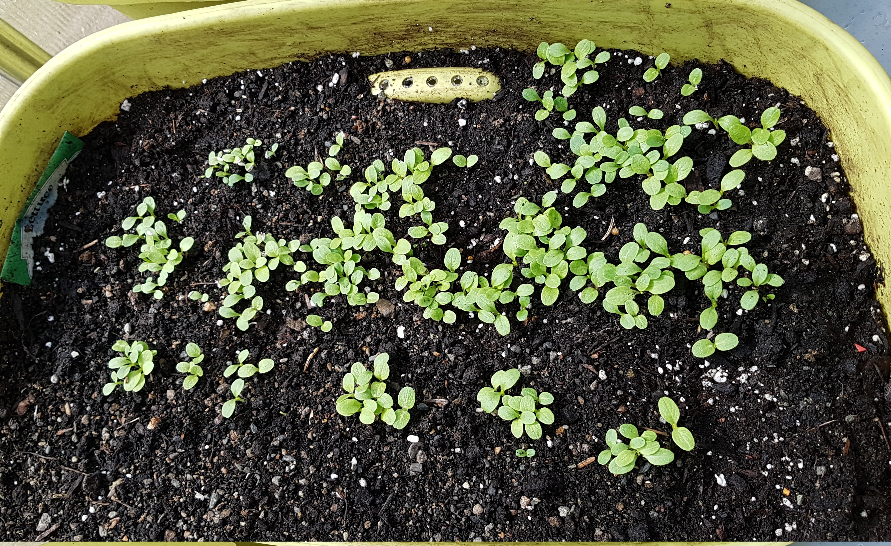
I saw some lettuces growing nicely in my greenhouse.
picture
I created a really messed-up topo map on my server. Something went wrong with the algorithm. I later learned it had to do with not deleting some temporary files left over from a previous run of the same program.
picture
Another day in my moss-covered, misanthrope’s paradise.
picture

Caveat: Rendering Rocks and Trees

I spend a rainy afternoon making some pleasing and surprising progress on my “map server” architecture that is one of my chief hobbies.
One thing I want to be able to do is to eventually create and host my own “contour” (elevation) data for my geofictional places. Currently, this contour work is hosted at the OGF website, e.g. my island called Tárrases (link to the contour map). I want to be able to host this type of map on my own server.
It’s quite intricate to use raw GIS (geographic information services) data to “draw” one’s own digital contour maps.
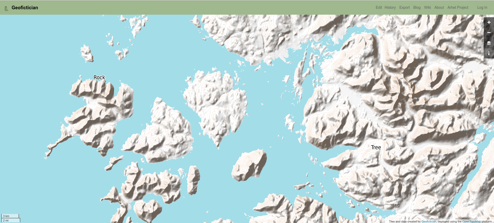
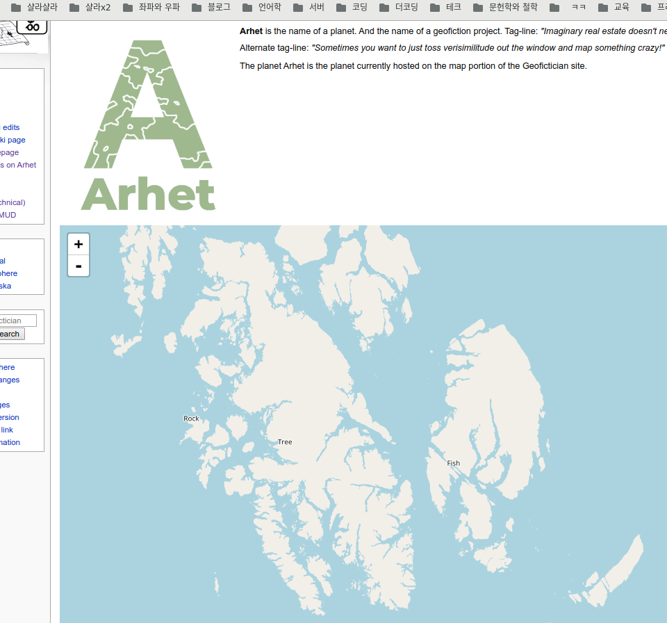
As a first step, I have imported the raw data for a small corner of my home in Southeast Alaska to my server. This is digitized planetary height data, freely available from the NASA website. After nearly 3 months of on-and-off effort, I have finally managed to render (draw) the contour map, using the OpenTopoMap architecture (a Mapnik render architecture). Note that this really is only contour data – I didn’t import the other real-world map data, and in fact only placed a few of my own invented towns, such as the towns called “Rock” and “Tree” on the map. The town of “Rock” is out at northern tip of Noyes Island, where Arthur likes to go fishing. It’s a rocky little cape. The town of “Tree” is my home, of course.
Here is a link to the current server, but I’ll include a screenshot below, since the link might end up evolving or changing as I continue refining this effort. You can click that screenshot to enlarge it.
picture
picture

Caveat: Isolated activity

I am normally living an isolated lifestyle. So this period of “social isolation” during the virustime doesn’t imply any kind of true lifestyle change for me, whatsoever.
One thing I continue is my geofiction hobby. Here, for lack of anything more interesting, is a cross-post from my other blog (which is pseudonymous and focused on geofiction).
———————————————————————-
I keep making small incremental progress on the imaginary city of Ohunkagan. I start to imagine the city it will be when I reach the “present” – from the perspective of around 1900, which is its current historical moment.
picture
[Technical note: screenshot taken at this URL (for future screenshots to match).]
You can see that the near-northeast has filled in (Balto area). Also, the Conagher Rail Car Company, in the southwest along the portage shoreline, and the Signal Hill area straight west near the line with the town of Mythic.
I have done work farther out, beyond the frame of the “standard” screenshot above, including work at Iyotanhaha, Riverton and Prairie Forge. All these towns will be within the Metropolitan Area’s modern perimeter, once we reach 2020.
———————————————
What I’m listening to right now.

Tears for Fears, “Mad World.”
Lyrics.

All around me are familiar faces
Worn out places, worn out faces
Bright and early for their daily races
Going nowhere, going nowhere
Their tears are filling up their glasses
No expression, no expression
Hide my head I want to drown my sorrow
No tomorrow, no tomorrow
And I find it kind of funny
I find it kind of sad
The dreams in which I’m dying are the best I’ve ever had
I find it hard to tell you ’cause I find it hard to take
When people run in circles it’s a very, very
Mad world
Mad world
Mad world
Mad world
Children waiting for the day they feel good
Happy birthday, happy birthday
Made to feel the way that every child should
Sit and listen, sit and listen
Went to school and I was very nervous
No one knew me, no one knew me
Hello teacher tell me what’s my lesson
Look right through me, look right through me
And I find it kind of funny
I find it kind of sad
The dreams in which I’m dying are the best I’ve ever had
I find it hard to tell you ’cause I find it hard to take
When people run in circles it’s a very, very
Mad world
Mad world
Mad world
Mad world
And I find it kind of funny
I find it kind of sad
The dreams in which I’m dying are the best I’ve ever had
I find it hard to tell you ’cause I find it hard to take
When people run in circles it’s a very, very
Mad world
Mad world
Enlarging your world
Mad world

picture

Caveat: a brief incursion of reality

… Not what you think.
On my homegrown geofiction server, I have temporarily imported some of the southeast Alaskan islands, because I want to test some functionality and sometimes using real-world data is easier. But I only brought in the coastlines for this island, and some nearby islands, but skipped the continent. I decided to make my own towns, somewhat tongue-in cheek. You can see them on this screenshot, below.
picture
picture

Caveat: Best of Arhet, Week 5

[This is a cross-post from my other blog.] The best mapping in Arhet for this week. User Moskva, here. picture I feel a need to comment on this selection. It is definitely not my preferred style. The geography and patterns of settlement are interesting and well-done, but there are too many motorways relative to underlying detail – there basically is no detail at higher zooms. That’s why the whole thing is being done at reduced scale (i.e. I believe 1 km on Arhet’s globe represents 10 km?). That said, I appreciate the effort going into it and it’s clearly serious geofiction. Music to map by: Goo Goo Dolls, “Name.” CaveatDumpTruck Logo

Caveat: documentation of my geofictions

Some of you might recall, I have another blog, besides this one. I maintain that blog mostly because this here blog is tied to my real-world identity, but I prefer to remain a little bit anonymous (obfuscated and pseudonymous more than truly anonymous) on the geofiction websites where I work and interact on what is really one of my main hobbies. I don’t post there very often – nothing close to daily, as I do here. A few times a month, on average. So this morning, I ended up writing a quite long entry on that other blog. It also has a number of included images, etc., so rather than reproduce it here (which would be complicated because my two blog platforms are truly independent, and I’ve got them configured quite differently), I’ll just give you a link:

Documentation of my geofictions, at blog.geofictician.net. Consider this to be my blog-post of the day, but off over on that other blog.

[UPDATE: On reconsideration, I’ll directly cross-post (cut-paste) that entry here following, for posterity’s sake.]

I was inspired by a recent bit of “OOC documentation” by the OGF user donnamaw (here) to discuss, if only in outline form, the real-life origin stories of my various geofictions. How and when did I invent, in my imagination, the various places that I have drawn (or attempted to draw) maps of? The order in which these places were drawn or introduced to geofictional spaces is not the order in which my mind created them. Here I’ll try to present them in the order in which they were first imagined.

Rahet.

Rahet is a planet. It has four main continents, which bear a reliable suffix meaning “continent,” -eye (pronounced as IPA /eje/). The history of Rahet is one of human colonists settling a desert planet and terraforming it over 1000’s of years. The terraforming process is frequently interrupted by squabbles among the factions that emerge, but nothing is stable, and few nations and groupings last more than a few generations. The technological level is high but unequally distributed – you have spaceships and artificial intelligent machines coexisting with spears and chariots. There is a particular faction, led by a machine named “Zon,” which keeps the terraforming project more-or-less “on track,” but often at the cost of moral clarity. All of this was developed in my imagination beginning around the age of 10. I was a bit precocious as a child, and by 10 I had read the Lord of the Rings, the Dune books by Frank Herbert, and numerous other pulp sci-fi works by authors such as Andre Norton, Alan Dean Foster, and Harry Harrison, among others. These types of works influenced my thinking about Rahet, and by age 12 or so I had a quite clear picture of the planet’s historical trajectory and some of the key elements of the culture. I began drawing maps early. Most were focused on the continent called Tsiqeye, which is where the earliest settlements were established, around a rock formation called Redithk Illim (which resembled in my imagination Wyoming’s Devil’s Tower, but much larger). I remember drawing out an outline of the continent with coastlines and major rivers at around age 11, taking it down to the photocopy store (such as life before scanners and cheap, high quality printers), and making a hundred “blanks.” I numbered them at 50 year intervals (thus covering 5000 years of history), and then drawing a series of historical maps for the nation-states, tribes, empires and other factions playing out Rahet’s complicated and intricate history. I wish I still had those maps. A few years ago I uploaded Rahet to my new geofictician server, but later deleted it, deciding I wasn’t ready to dedicate an entire server to the project. Here is a (sadly blurry) screenshot from that time when it was uploaded.

picture

Rahet has remained a constant in my imagination ever since my pre-adolescent years. Note that the name is an anagram of “Earth.” Here is a map I found just recently, of the Rahet continent called Preye. I believe I was in high school when I drew this (early 1980s).

picture

Ta Hre.

Ta Hre is another planet that was created around the same time as Rahet. It exists in the same universe, but rather than being an earth-like, terraformed planet it’s an airless moon, with people living in pressurized “cities” laid down in craters and canyons in the moon’s surface. I never really attempted to draw maps of the planet as whole, but I did draw many of these enclosed cities – often not just standard airplane-view maps, but also elevation diagrams of the various levels of the cities, since they were fully three-dimensional. Ta Hre is another anagram of “Earth,” of course.

Mahhal.

Mahhal is a few years younger than Rahet. I created it in high school. In fact, it started as two separate planets/cultures that I merged into one when I was in college. The first, which gave the name of the planet, Mahhal, was created as a kind of “antagonist” to Rahet. I had started trying to write a novel about Rahet, and I needed some “bad guys” so the novel would have a strong life-or-death conflict. I created the Mahhalians as an alien group who arrived at Rahet at some point and attempted to conquer it. They mostly failed, but they maintain outposts and fight occasional skirmishes with the Zon faction which works to protect Rahet’s independence. Over time, I created the Mahhalians’ background, including a conlang and ideas about their culture and planet. They are a kind of dystopian theocracy, but very high tech. They are humanoid (and in my never-completed novel, I leave as a kind of open mystery whether the Mahhalians are mutant humans or an unrelated species). They live on a world that is currently in an “ice age,” thus there are permanent ice caps on both poles and extending to about 40° latitude. Only the equatorial zones are habitable, but the Mahhalians have built vast, high-density cities, often protected by strings of giant domes across the landscape. The other geofiction, created at the same time, I called Pas Daons. It wasn’t a whole planet, but a country. In particular, I created the cities called Derindonderak and Askendom. In its first iteration, Pas Daons wasn’t a high tech or alien society. It was just a kind of alternate Earth, such as would fit in well on OGF today. I drew a detailed “city atlas” on paper of the city Derindonderak, and I still have clear visuals of the city’s layout, its topography, street plan, etc. However, by my second year in college, I’d “borrowed” Pas Daons to give more detail to my Mahhalians, and thus Derindonderak became the commericial capital of Mahhal, and I came to see Pas Daons as a “historical snapshot” of the more advanced Mahhalians. Rahet/Mahhal and the novel that was set there were abandoned when I moved to Mexico, and lay dormant until I attempted to resurrect Mahhal as an OGF archipelago in 2015. I had to make a lot of compromises with respect to my original vision for the Mahhalians – they had to be demoted from high tech, planet-controlling aliens to mediocre humans confined to a high-latitude archipelago. They retained their dystopian theocracy and conlang, however. At this point, I consider my effort to port Mahhal into OGF to be an abject failure. I became dissatisfied with the compromises I felt I’d been forced to make, and my hope to recreate the seething metropolis of Derindonderak (so vivid in my imagination) was disappointing. I retain a “rump state” version of Mahhal in OGF mostly to justify the existence of Tárrases (q.v. below) – and because I just like the name. It’s my oldest and most closely cherished imaginary name. Here is Mahhal as currently drawn on OGF (and link to boundary relation):

picture

Rasf-sayan.

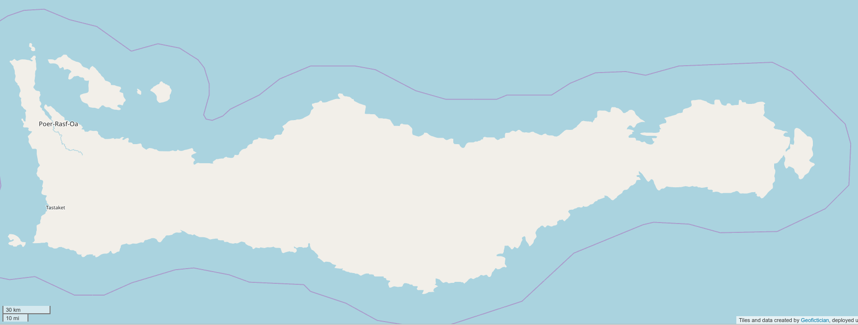
Rasf-sayan is another geofiction I developed in high school. In its first incarnation, it was a parallel-earth Caribbean island with a conlang meant to resemble a native American language. I modeled it socially and culturally on Haiti. I didn’t start a novel about Rasf-sayan, rather, I started an epic poem about a character named Aochra. He is fighting corruption and trying to save hopeless lives mired in poverty. He’s kind of a cross between “Blade” and Bob Marley. I drew lots of detailed paper maps of Rasf-sayan in high school, mostly focused on the main city, Poer-rasf-oa. At some point in college, I hijacked Rasf-sayan for my Rahet project. The hijacking was thorough and I don’t regret it. Rasf-sayan became an island on Rahet, in the sea between the continents of Preye and Sekieye. Rasf-sayan is mired in poverty because it is one of the pockets of Rahet controlled by the ruthless and inhumane Mahhalians. They have one of their space elevators anchored on the island, that allows them easy access to and from the planet. In the Rahet novel, the main character is trying to reach Rasf-sayan, because he needs to get off-planet. That’s his McGuffin that drives the plot. He meets Aochra, as a supporting character, and who is double agent – nominally working for the Mahhalians, but secretly allied with the Zon. Ultimately, any geofiction I draw of Rasf-sayan will be located and integrated to Rahet. Here is Rasf-sayan on Arhet, as of right now.

picture

It’s barely started. But I retained it when I deleted the rest of Rahet and made it into Arhet (see what I did there?), because I thought I’d work on it at some point.

Ardisphere.

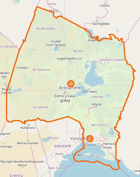
Ardisphere had a strange genesis. There is a novel by Vladimir Nabokov, entitled Ada. I believe there is a bit of geofiction (or at the least, alt-history) in that novel, since the Russians seem to control North America. An important setting in that novel is a place called Ardis Hall. I must acknowledge that that is the origin of the name Ardisphere. But… the imaginary country came after the name, by a few years. At first, I remember using the name Ardisphere for an early website I developed, as a kind of alternate identity where I would present my geofiction ideas or half-made novels. I made my first website in late 1994 (the web was only 2 years old at that time), on a thing called geocities – an early free website hosting service. I had a “professional” site that I used for my work at that time, and personal site, that was called Ardisphere. It was only a few years later, after I allowed the Ardisphere website to pass into internet history, that I started using the same name for an imaginary country. I had started a novel in which a group of refugees from earth, traveling in a sub-light-speed “generation ship,” arrive in another star-system with an earth-like planet, inhabited by a alien race that has a technological level similar to humanity’s. As refugees, the aliens decide to grant to the humans a few thousand square kilometers of mostly desert land they aren’t much using, to build their own refugee country. I drew a detailed map of Ardisphere. Since many of the refugees were from Latin America, most of the cities ended up with Spanish names. Hence Villa Constitución, Cerro y Casa, Puerto Desolado, El Cabo, Palmeras Grises. The names were such as I imagined a modern group of Spanish-speakers might apply to the alien planet they were colonizing while focusing on the ideals of their “new earth.” The novel was about a point in time about 100 years after the building of the settlement, at a point when aliens and humans have started to coexist in a hybrid culture. The novel, like all my novels, never reached any kind of finished state, but it included “Clarkean” magic (i.e. “any sufficiently high technology is indistinguishable from magic), criminal gangs from poor neighborhoods (the slums of VC), aliens engaging in conspiracies to control the humans they’ve welcomed to their planet, and humans doing the same in return, etc. The novel also has the seed of what later became the Cartographers and Cyclopedians – freemason-like secret societies that play a large role in the evolution of life in the country. Interestingly, in the original map of the Ardisphere, it was a peninsula. When I first stumbled across OGF in early 2014 and made an account, I took the only green country I saw at that time, AR025. That wasn’t a peninsula. But I’d already decided to make Ardisphere my first OGF creation. That was partly because I felt that, among all my sci-fi geofictions, it would be the easiest to adapt to the OGF “real world” style setting. I had to rearrange the geography completely to fit the peninsular Ardisphere of the novel into the oddly shaped, mostly land-locked territory in western Archanta. But I consider the adaptation to be successful: I cannot visualize Ardisphere at all in my mind now, without calling to mind what’s become the iconic shape of AR025. Since aliens weren’t allowed on OGF, and since I was living in Korea at the time, I made a spur-of-the-moment decision that my Ardispherian aliens would be Koreans. I don’t regret my decision. The Latin/Korean hybrid that OGF Ardisphere became is intriguing and has a lot of interesting cultural details. I am currently undecided as to the fate of the OGF version of the Ardisphere. One part of me still eagerly wants to complete (or more accurately, restart) the novel set there, with changes to “fit” the OGF setting. I see it as a kind of thriller/detective novel set mostly in VC, with travels to other OGF places – Jeongto, Tárrases, Ohunkagan, Gobras City… Further, It was only after embedding Ardisphere in OGF that I began imagining my characters might become aware they were in a geofiction, and begin manipulating it. This has given a great deal of new interest and impetus to whatever plot I finally come up with. Another part of me wants to restore the aliens and the high tech magic and re-draw Ardisphere on its own server, unconstrained by OGF’s strictures about verisimilitude. I also feel like removing Ardisphere from OGF because I’ve been so inactive with mapping there, and I feel it is not fair for me to occupy territory on OGF that I’m not actively working on. Here is Ardisphere as currently drawn on OGF (and link to boundary relation):

picture

Lekista.

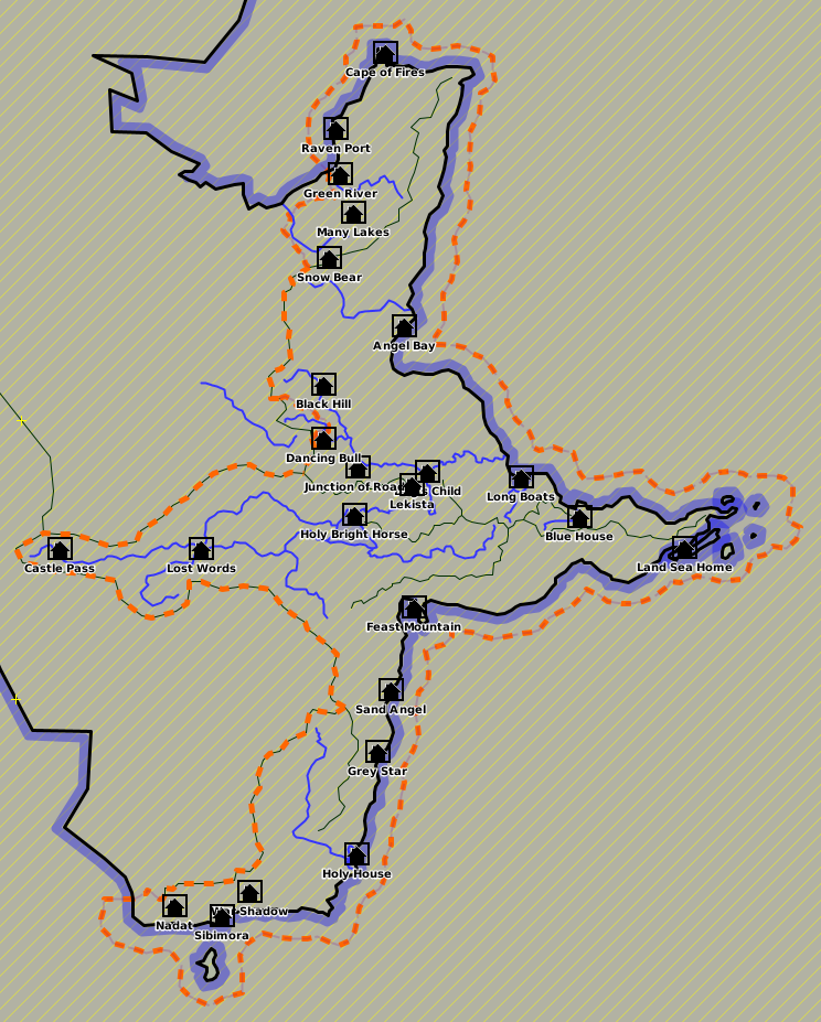
I started a novel in around 2002 which was set in a steampunk universe, but in which the main character was modeled on Augusto Pinochet, of all people. I had been reading Pinochet’s autobiography, and I had had this thought: “That is a seriously sociopathic dude. There needs to be a fictional version of him.” So the story was, roughly, parallel to Pinochet’s life, and written from his perspective, but through the book you realize that the protagonist is a brutal dictator and he’s not a reliable narrator. It’s one of those “psychopath as protagonist” books. I wanted to create a parallel Chile, as a place where the novel takes place, but I wanted to change the details enough that it wasn’t recognizable as Chile. So I made it a steampunk setting, and I created a somewhat alien culture. Instead of creating a conlang or using Spanish, as in Chile, I made what still feels like an inspired decision to “hint” at a conlang, but not bother with actually creating it. Thus all the place names in Lekista are “translated” into English. You have the country’s capital, Holy Brighthorse. Other cities such as Castlepass, Feast Mountain, Dogschild, etc. The names lend a bit of a native American feel to the story and setting, since a similar thing occurred with a lot of native names, especially on the Great Plains: Sitting Bull, Red Lake, Crazy Horse, Moosejaw, etc. Eventually I gave up on the novel. I found fake-Pinochet’s mind too uncomfortable to inhabit. But I was quite pleased with Lekista, and drew many paper maps of the country and its cities. In 2013 I drew a map, just a sketch, where Lekista was integrated to Rahet. So as of the present moment, Lekista is just one of the many hundreds or even thousands of polities that exist on Rahet. I think one of the things I like about Rahet is that its diversity allows it to “host” so many of my formerly independent geofictions. Here is Lekista in JOSM.

picture

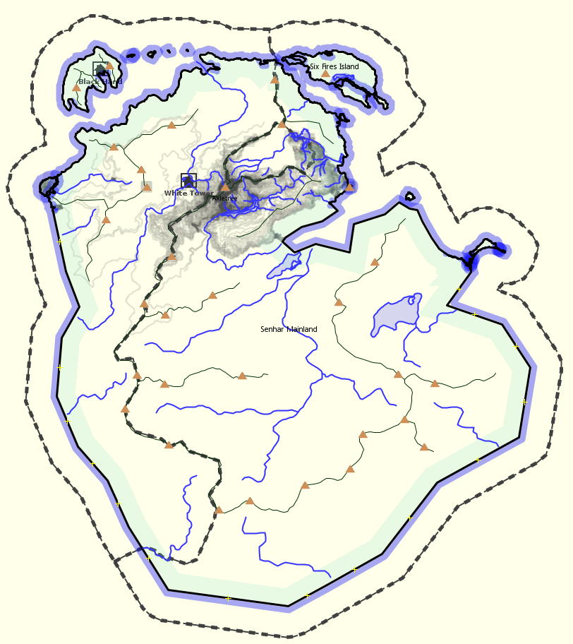
Senhar.

At some point while developing Ardisphere in 2015, I began thinking about Ardispherian religion. In the original, novelistic Ardisphere, religion and strange beliefs about psyche and the paranormal play a major role. But it’s largely “alien” and tied in with the aliens who intermingle in Ardispherian society. That was not an option for OGF Ardisphere. So since the aliens had become Koreans, it seemed logical for the alien religion to become … Buddhism. I created Gautamism as the OGF version of Buddhism, and made it the main religion in Ardisphere. Bear in mind that since the late 1990s, I myself have been a semi-practicing Buddhist, so this is not a stretch for me. In OGF-world, though, names must be changed. And source places, too. I invented Senhar to be the home of OGF Buddhism, and began drawing maps of it offline. It is meant to be an equatorial island nation, modeled on Sri Lanka (not the real home of Buddhism on earth, but an important nation for the historical development of the religion nonetheless). But in the center of the large island I placed an extreme highlands (over 5000m), which would allow me to also include an OGF Tibet. Thus Senhar is a Sri Lanka / Tibet hybrid country. Since I have zero competence in the Tibetan and Sinhalese languages, I decided to go the conlang route, and invented a Senharian language that would be a bit based on Korean (which I do know) but written using Tibetan characters. Here is a screenshot of Senhar from JOSM, which is where it exists for now, with incomplete contour work.

picture

If anyone ever creates an OGF India, it would be my intention to petition admin, at that time, to allow me to place the island of Senhar off that country’s coast.

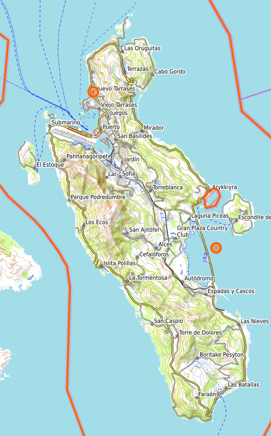
Tárrases.

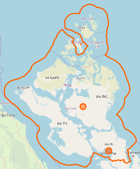
I created Tárrases exclusively because I felt I needed to try to make a microstate where I could focus and develop my mapping skills using JOSM and OGF. I wanted something I actually could “complete” in a reasonable amount of time. Secondarily, I wanted a place where I could allow my two main OGF societies to “meet.” Hence Tárrases was inspired by Spanish (Ardispherian) and Mahhalian cultures. I placed it as a libertarian enclave in dictatorial and theocratic Mahhal – a kind of Macau or Hong Kong to a Mahhalian China, in a geopolitical sense. I believe Tárrases is my finest and best-developed geofiction to date – exactly as it was intended. I’m very proud of it. As I was mapping it, I thought a lot about what kind of culture it was. I wanted something with maximal contrast to Mahhal’s rigidity, so I settled on a kind of libertarian-anarchist state. In fact, I was inspired by Tamarindia, which I pointed to at the beginning of this write-up. Tárrases was founded by pirates, who “stole” a Castellanese colony by making an unholy alliance with the Mahhalian aristocracy. They went “legit” and the Carapreta Dynasty, founded by the pirate Omar, has survived for over 200 years. Here is Tárrases as currently drawn on OGF (and link to boundary relation):

picture

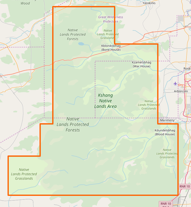
Kshang.

I still believe in this project, but I’ve negected it hugely. I would someday hope to resurrect it in a more hospitable setting than hapless Rhododactylia. The

Kshang are imagined as a parallel to one of the many ethnic groups in South Africa (since I’d decided somewhat arbitrarily that Rhododactylia was a kind of OGF South Africa, maybe). I think in fact the Kshang began as a conlang, and the geofiction came later. It’s possible that I had a conlang that looked like Kshang even in high school. And I remember sketching maps for them, too, but they weren’t very detailed. It was meant to be a pre-modern society. But I know Kbloniksbhag (Bone House) was the “capital,” such as it was. I spent more time developing the Kshang religion and culture, and thinking about life in a traditional Kshang village. I think my effort to place the Kshang as a major ethnic group in Rhododactylia was a failure – mostly because I lost hope of that country ever being in any way a coherent geofiction at all. They need a home of their own, a little OGF Botswana or something. Here is Kshang as currently drawn on OGF (and link to boundary relation):

picture

Bofobunda.

I invented Bofobunda in 2016 (I think) at a point in time when I was thinking of a way to make West Commonia culturally interesting, in the way Gobrassanya is interesting. I had orchestrated the “divorce” of West Commonia from Commonia, and so I had intended to place some mapping there. I wanted a stand-alone project, so I created the Bofobundans. I got distracted by their language and culture, something vaguely southeast Asian but with a conlang written with the Farsi (modified Arabic) script. So I never uploaded any of the mapping to West Commonia. And I’m glad I didn’t – someone would have surely destroyed it beyond recognition by now. I “rescued” the Bofobundan culture from obscurity by placing them as a small minority in Ardisphere, with a concentration of population at the city of Lagartopolis, where they have a large, famous mosque. I would like to work on that more. Their home country remains unmapped. Here is the capital of Bofobundah, the city of Zhebeyem. This was my first experiment with contours and maperitive – a largely failed experiment.
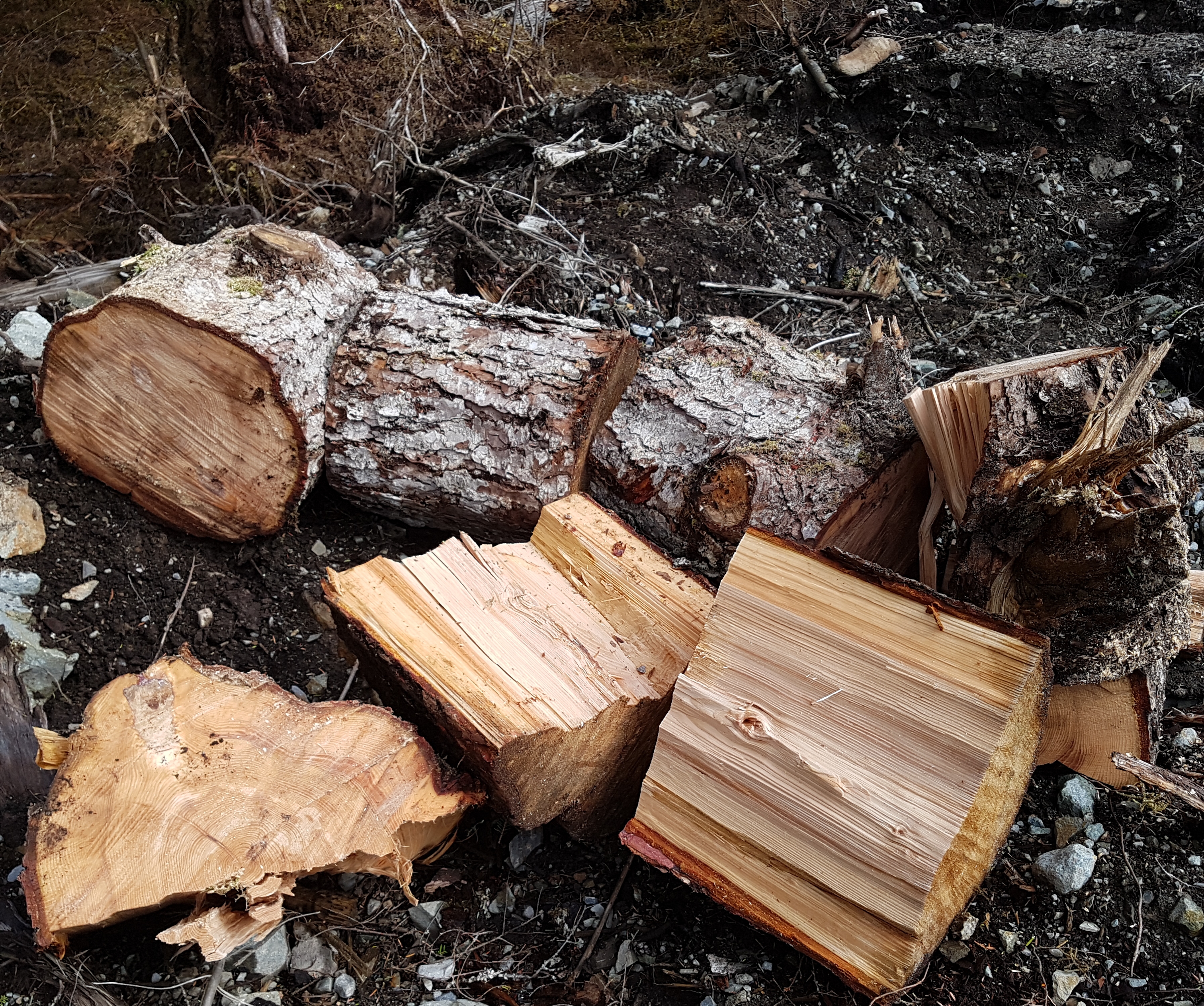
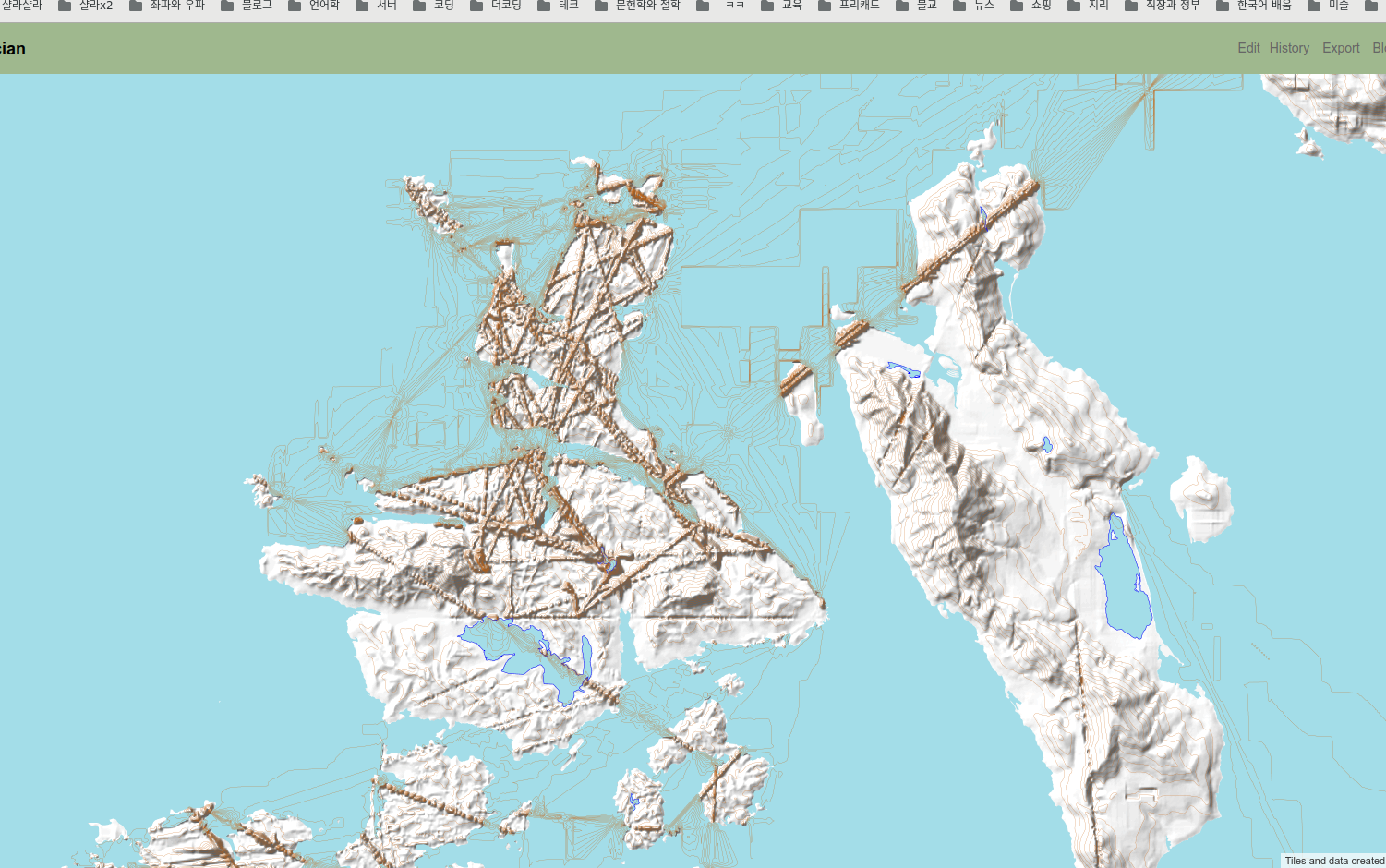
picture

Makaska.

Makaska is my newest OGF project. Currently, I view its success as second only to Tárrases, and on a much larger scale. Unlike Tárrases, it’s far from finished. Like Tárrases, I think Makaska has been successful partly because I created it for OGF. It’s OGF-specific, and thus I don’t feel any regrets about editing out any formerly existing inverisimilitudinous elements, due to OGF’s rules. Once I’d kicked off the FSA project, I began thinking about how I could participate by taking on my own state, on the principle of “lead by example.” I wanted to make an exemplar FSA state. My thoughts turned to my years living in Minnesota. I had studied the Dakota language in college, there, and since I wanted my FSA state to have a strong “native” presence, and I wanted it to feel authentic, an OGF Minnesota seemed logical. I pulled out my trusty English-Dakota dictionary from college, and got started making up names. So far, I’m happy with it. It’s a work-in-progress, and is my main “active” geofiction, right now. Here is Makaska as currently drawn on OGF (and link to boundary relation):

picture

Deadlands.

The Deadlands is not the same as the other geofiction projects, above. The background is that for a while while living in Korea, I resurrected an old habit I had from the late 1980s – I started playing MUDs (text-based computer role-playing games). But when I started maintaining my own Linux server in 2016, I went further. I decided I should build my own MUD. So I started to. It’s currently offline, regrettably. It’s called Hellbridge, and it’s a post-apocalyptic/fantasy hybrid that takes place in an inverisimilitudinous setting called The Deadlands. Here is a screenshot of the Hellbridge MUD login.

picture

My intention was to actively integrate the OSM-style slippy map with the game, so that players could follow their progress in the game world with a marker on the website map. So I have been experimenting with non-standard tagging of nodes that I could tie into the MUD database through some kind of customized database procedure, such that a character’s “current location” could be tied to a pin on the map, google-maps style. Here is a map window (leaflet) with a test marker, showing the map-in-progress of the village of Goodgrove – intended to be one of the “starter villages” for new characters exploring the Hellbridge universe.


I don’t know what made me write all this, just now. Perhaps I grew tired of typing out the same explanations over and over on the OGFC Discord, or in conversations in the OGF Forums and diaries. So now I can just point people here. I might add to this write up with more detail over time. Music to do meta-geofiction to:

Apoptygma Berzerk, “Kathy’s Song.” picture

Caveat: rootless

Sometimes I work on my server. I have been trying to automate the map-rendering job for the geofiction site I built, that until now I’ve had to run manually. The problem I ran into comes down to permissions. Who knew that even the infamous Linux ‘root’ user is sometimes not the right person for the job? Emphasis added to the excerpt of the log file, below.

...
INFO: Total execution time: 16621 milliseconds.
Stopping renderd (via systemctl): renderd.service.
osm2pgsql version 0.95.0-dev (64 bit id space)
Using lua based tag processing pipeline with script ~/src/openstreetmap-carto/openstreetmap-carto.lua
Using projection SRS 3857 (Spherical Mercator)
Osm2pgsql failed due to ERROR: Connection to database failed: FATAL:  role "root" does not exist
...

It took me all day to figure this out. Not that I was working on it, exactly. Art and I went to town, did our shopping, came home, ate dinner. All the while, I was cogitating on this problem, and how it matched up with the results I was(n’t) seeing. And then, sitting there, it clicked.
These are the more pleasing moments of computer work – when a seemingly intractable problem presents itself and you work it through in your mind and you solve it. After it clicked, I came and opened the log file and saw the error, above, and it was an easy fix to the bash script.
picture

Back to Top