Last September, I posted on this here blog about my fictional city-state of Tárrases, and the online mapping I’ve been doing for it. Recently, that website’s owner has been experimenting with a “3D viewer” of the topographic data. If you were interested in that map, before, then you might be interested to play with this viewer, too. Note that it is a bit glitchy, with some performance hitches, and also that the data (which are my creation and responsibility to maintain) might have some issues too. Also note that the initial view you see has the vertical scale exaggerated. The controls at the lower left of the window can change the degree of exaggeration, as well as manipulate for “pan,” “rotation,” and “zoom.”
So at least my hobby is interesting to me.
![]() [daily log: walking, 7km]
[daily log: walking, 7km]
Day: February 15, 2017
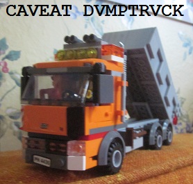
Caveat: Englyn #94
(Poem #199 on new numbering scheme)
I'm plummeting through life: down...
Voices on all sides: a din...
Days end; days begin: each dawn...
Without purpose - but not done.
– an englyn proest dalgron
